✅ Diverse formaten
✅ Niet goed, geld terug
✅ Meer dan 30 jaar ervaring
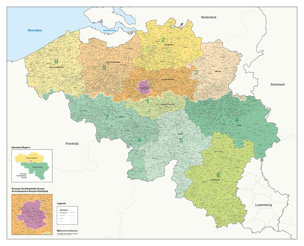
Complete Postal Code and Municipality Map of Belgium
A four-digit postal code map combined with all sub-municipalities and merged municipalities
An extensive map of Belgium showing all municipalities, districts and related administrative divisions
Looking for a map that provides a complete overview of postal codes and municipalities? This detailed map of Belgium brings together a wide range of administrative information in a clear and structured way. The map is carefully designed, combining a high level of detail with a clear, colour-based layout, making complex postal and municipal structures easy to interpret.
What makes this map distinctive?
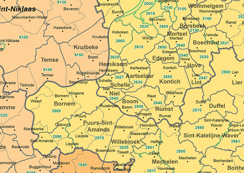
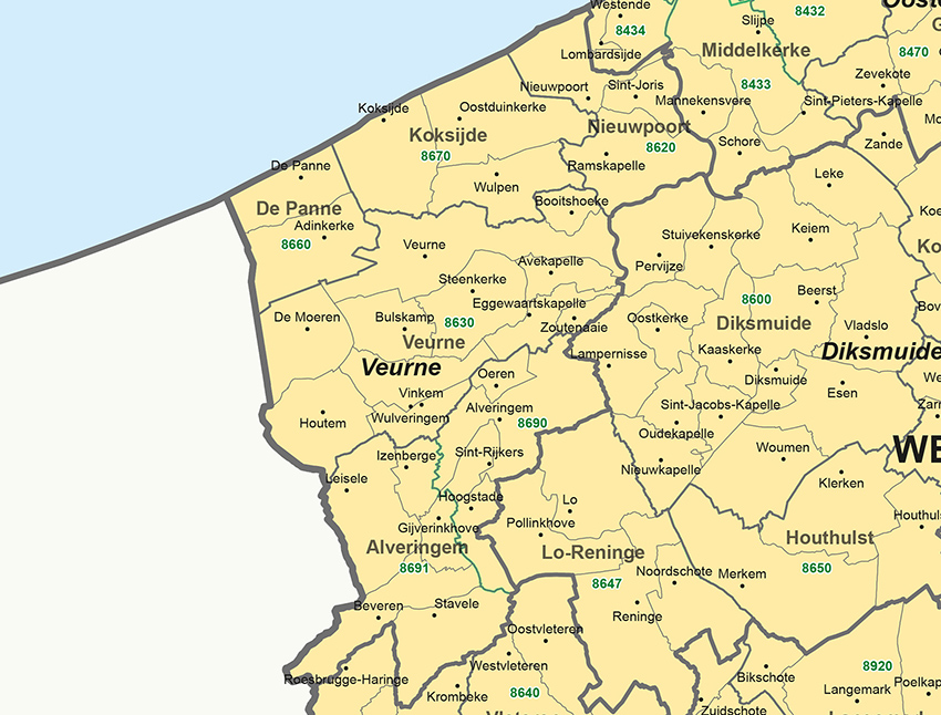
All sub-municipalities and merged municipalities The map shows not only the current merged municipalities, but also all sub-municipal areas. Each area is marked with clear boundary lines, allowing the administrative structure of Belgium to be understood at a glance.
Clear indication of districts In addition to municipalities, all administrative districts are clearly shown on the map. This added layer provides a broader administrative overview and supports a deeper understanding of Belgium’s territorial structure.
Postal codes and provincial colouring Each province is shown in its own colour, making provincial boundaries easy to recognise. Postal code areas are clearly indicated, adding practical value to the map and supporting quick geographic orientation.
Towns and villages marked with dots and names Each settlement within the sub-municipal areas is indicated with a dot and a name, ensuring that even the smallest villages are clearly represented.
This map serves as a valuable reference for organisations that work with geographic coverage on a daily basis. It is particularly useful for gaining clear insight into service areas, administrative structures and regional divisions, supporting activities such as logistics planning, distribution analysis and market-oriented decision-making.