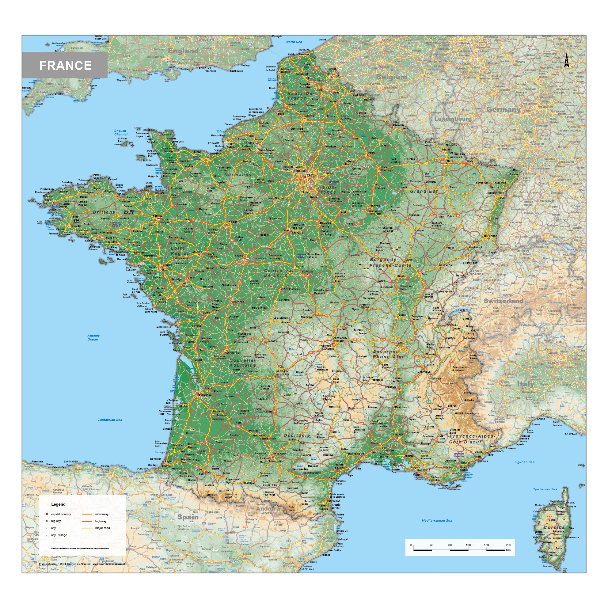
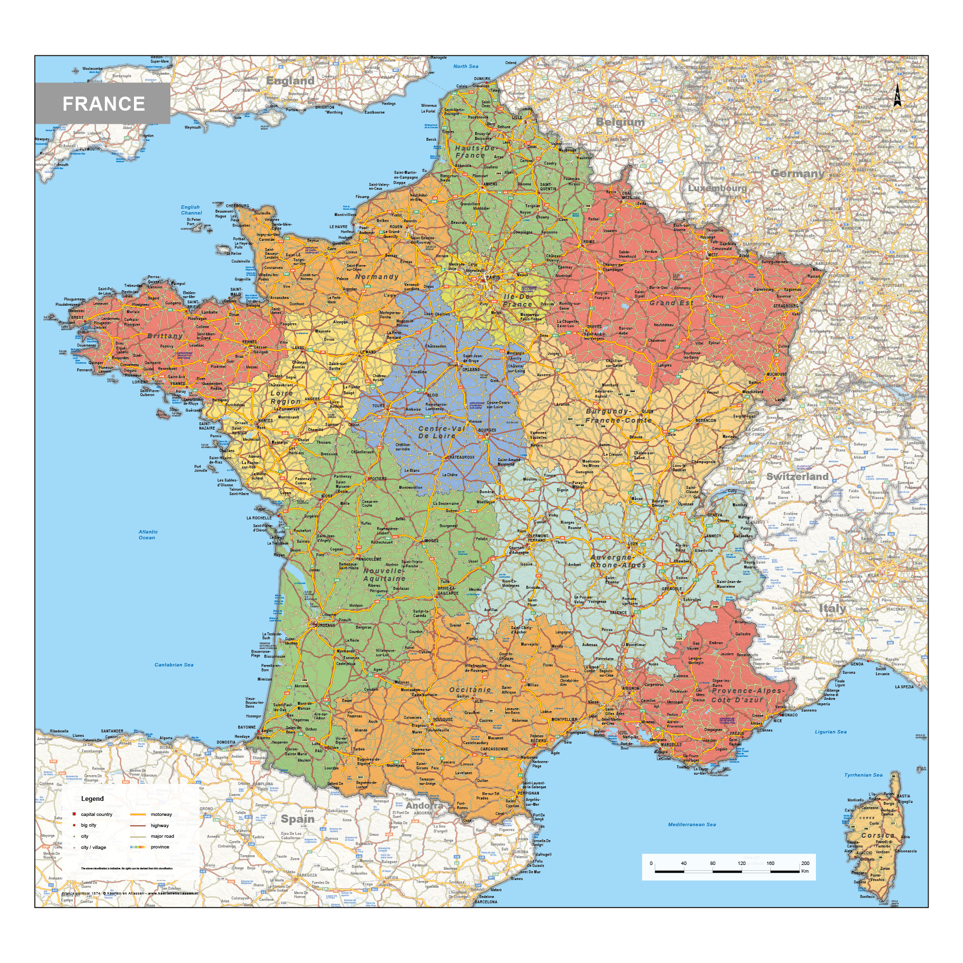
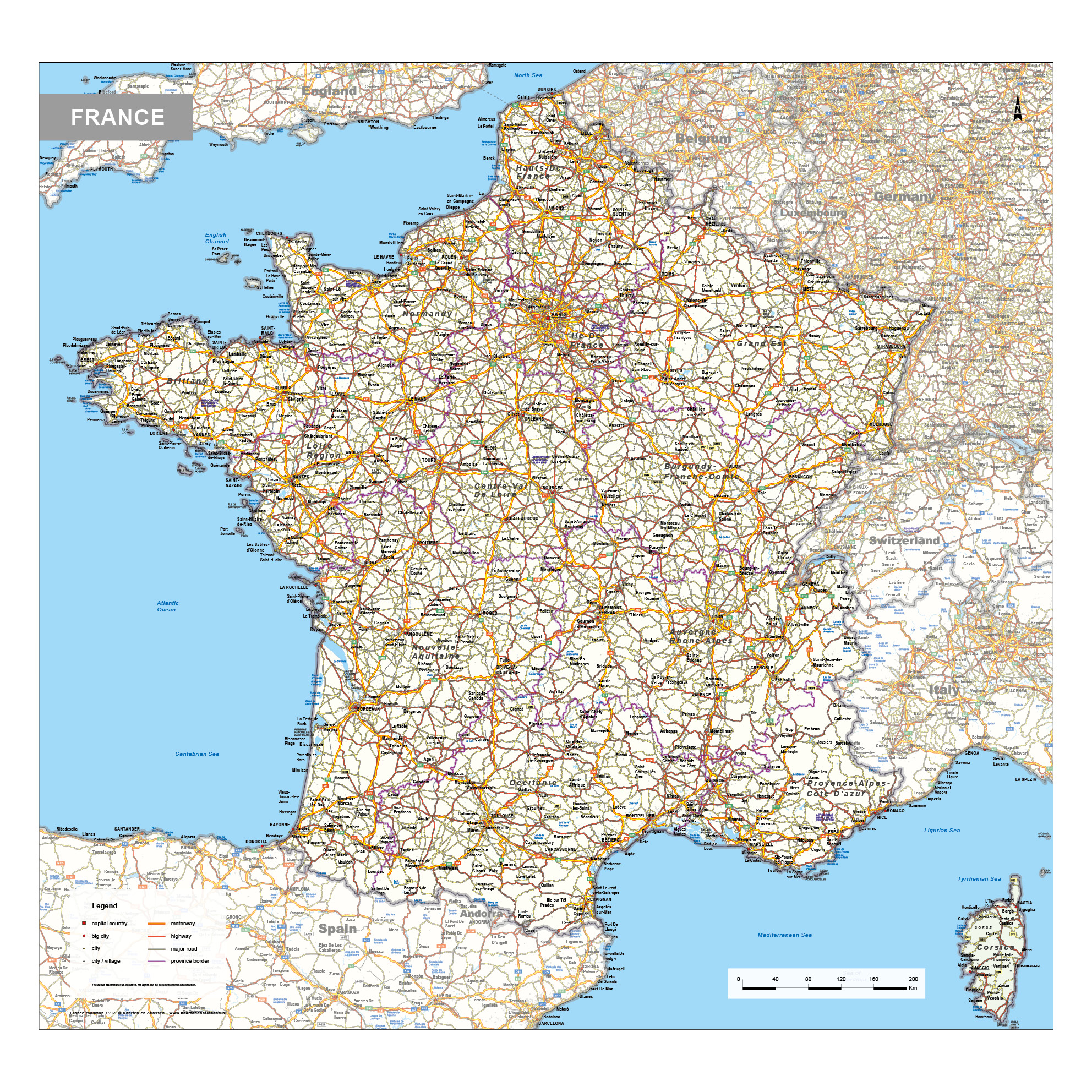
This category includes a varied collection of maps of France, covering political, physical and road-based representations. Political maps show national and regional boundaries, highlighting the country’s administrative divisions. Physical maps focus on elevation and natural features such as mountain ranges, river valleys and coastal areas. Road maps present the main transport network, including highways, regional roads and key connections between cities.
Combined, these map types provide a clear and well-balanced view of France’s geographic structure, suitable for reference, planning and educational purposes where accurate and readable mapping is required.