- Delivered as EPS & JPG
- High-quality downloads
- Over 30 years of experience
✅ Diverse formaten
✅ Niet goed, geld terug
✅ Meer dan 30 jaar ervaring
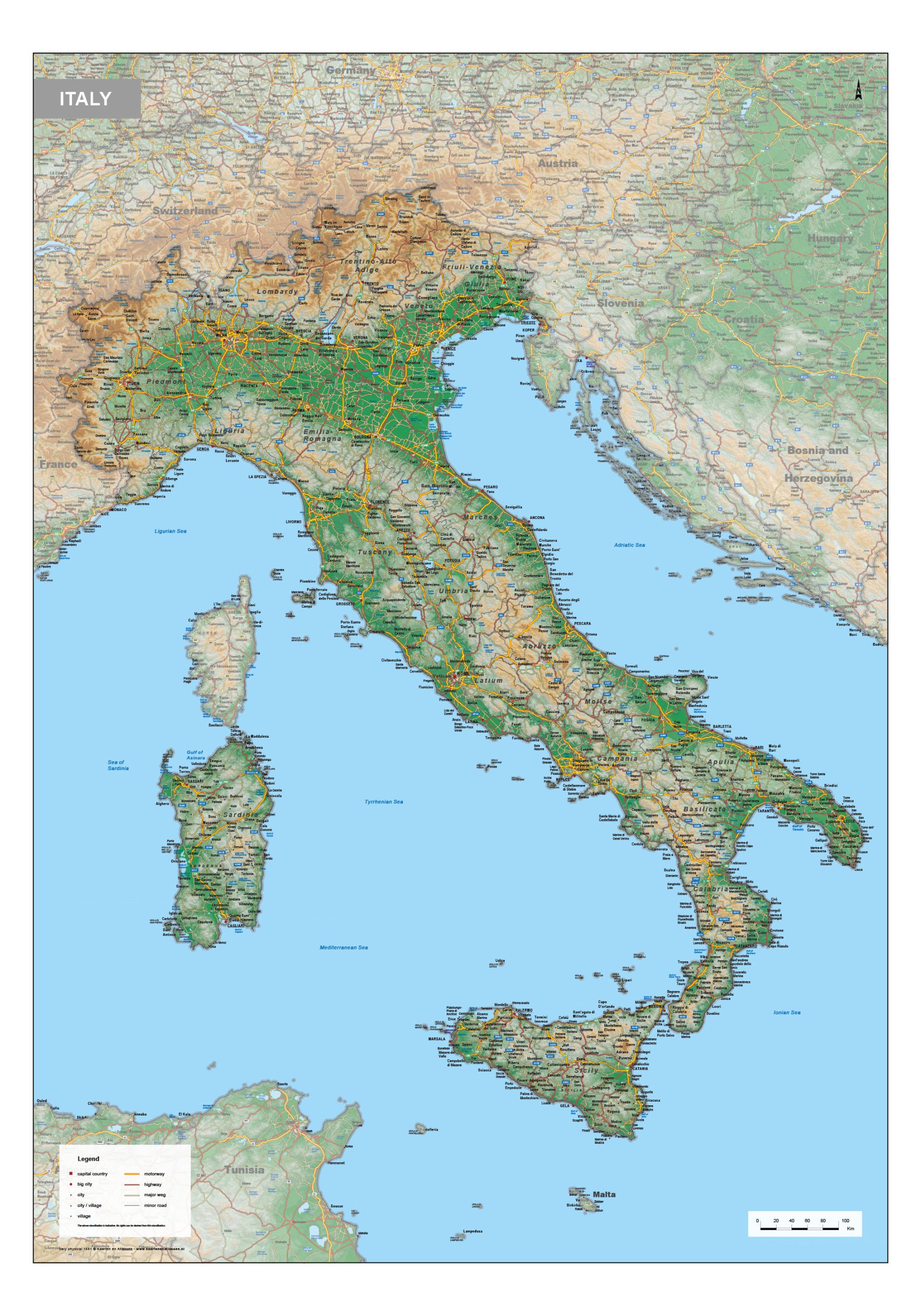
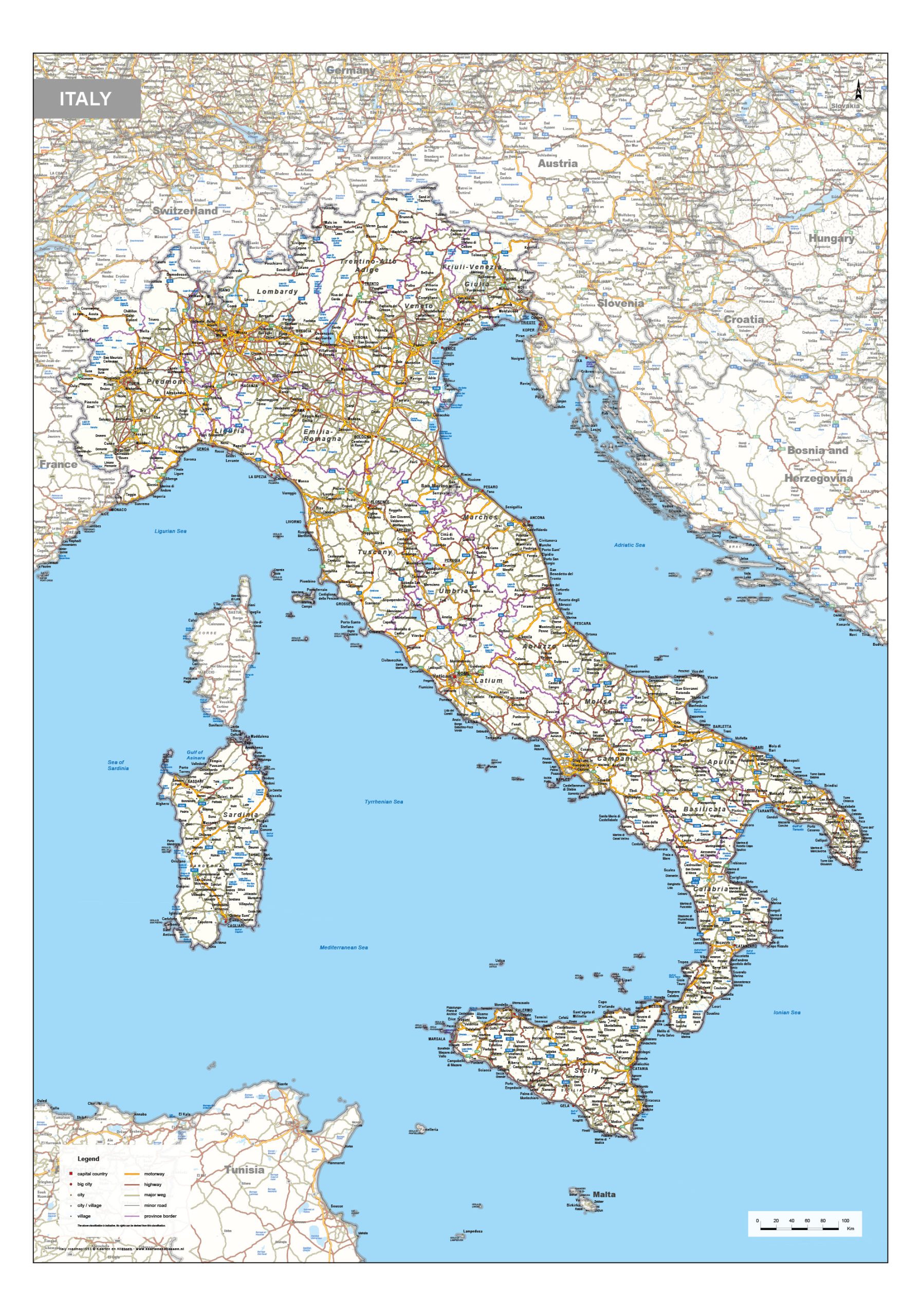
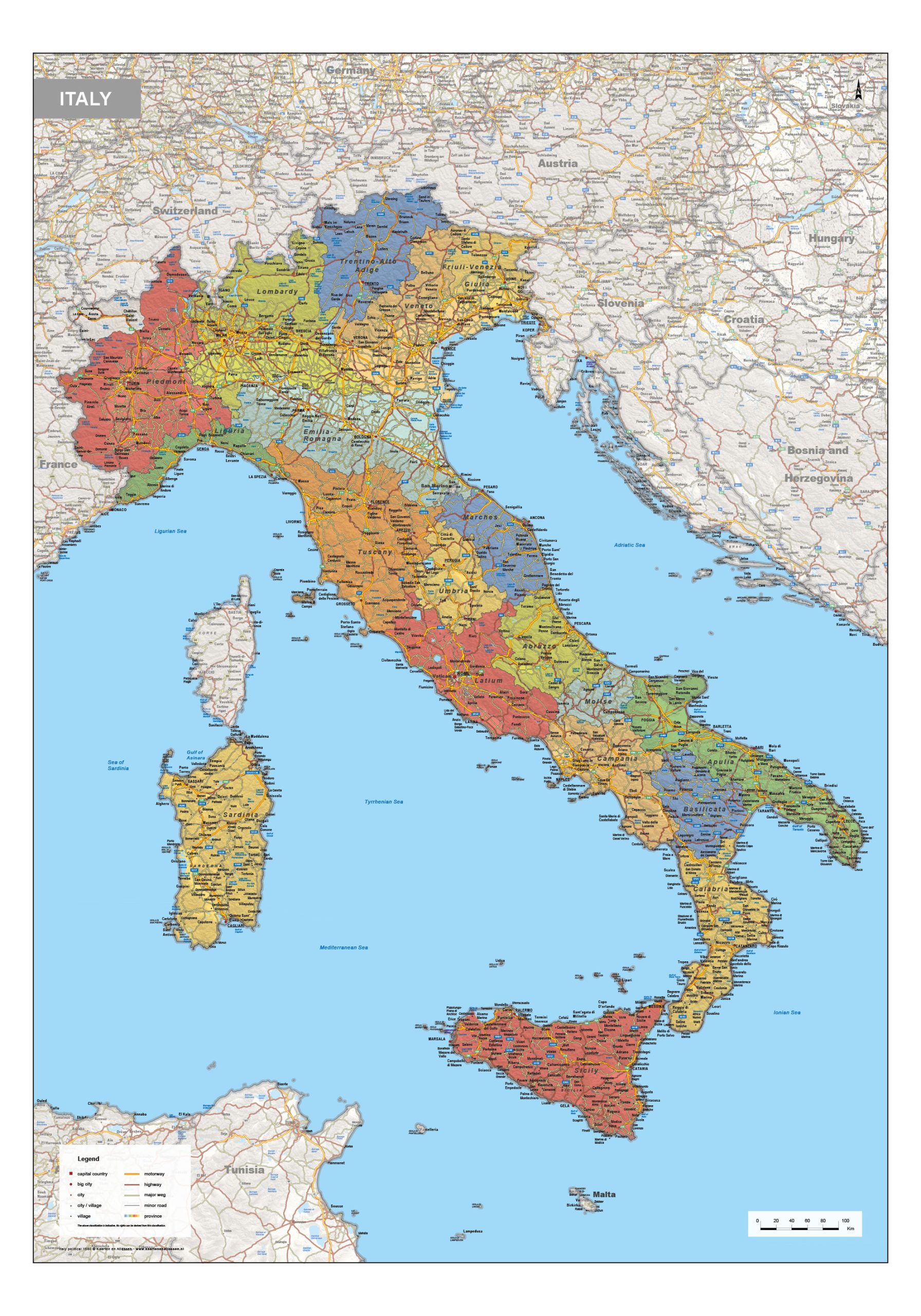
This category brings together a diverse collection of maps of Italy, including political, physical and road map editions. Political maps clearly show national and regional boundaries, highlighting provinces and administrative divisions. Physical maps focus on terrain and natural features such as mountain ranges, river systems and coastal landscapes. Road maps provide a detailed overview of highways, regional roads and key transport connections throughout the country.
Together, these maps offer a clear and informative view of Italy’s geographic structure, suitable for reference, planning and professional use where accuracy and readability are essential.
Professional, high-resolution vector files (EPS & JPG)
Accurate cartography across multiple projections
Suitable for education, publishing, design and research
Available in various styles: detailed, pastel, modern, scientific
More than 30 years of experience in cartographic production
Custom modifications available
If you need a map with specific colours, labels, languages or custom details, feel free to contact us at info@theworldofmaps.com — we’re happy to help.