- Delivered as EPS & JPG
- High-quality downloads
- Over 30 years of experience
✅ Diverse formaten
✅ Niet goed, geld terug
✅ Meer dan 30 jaar ervaring
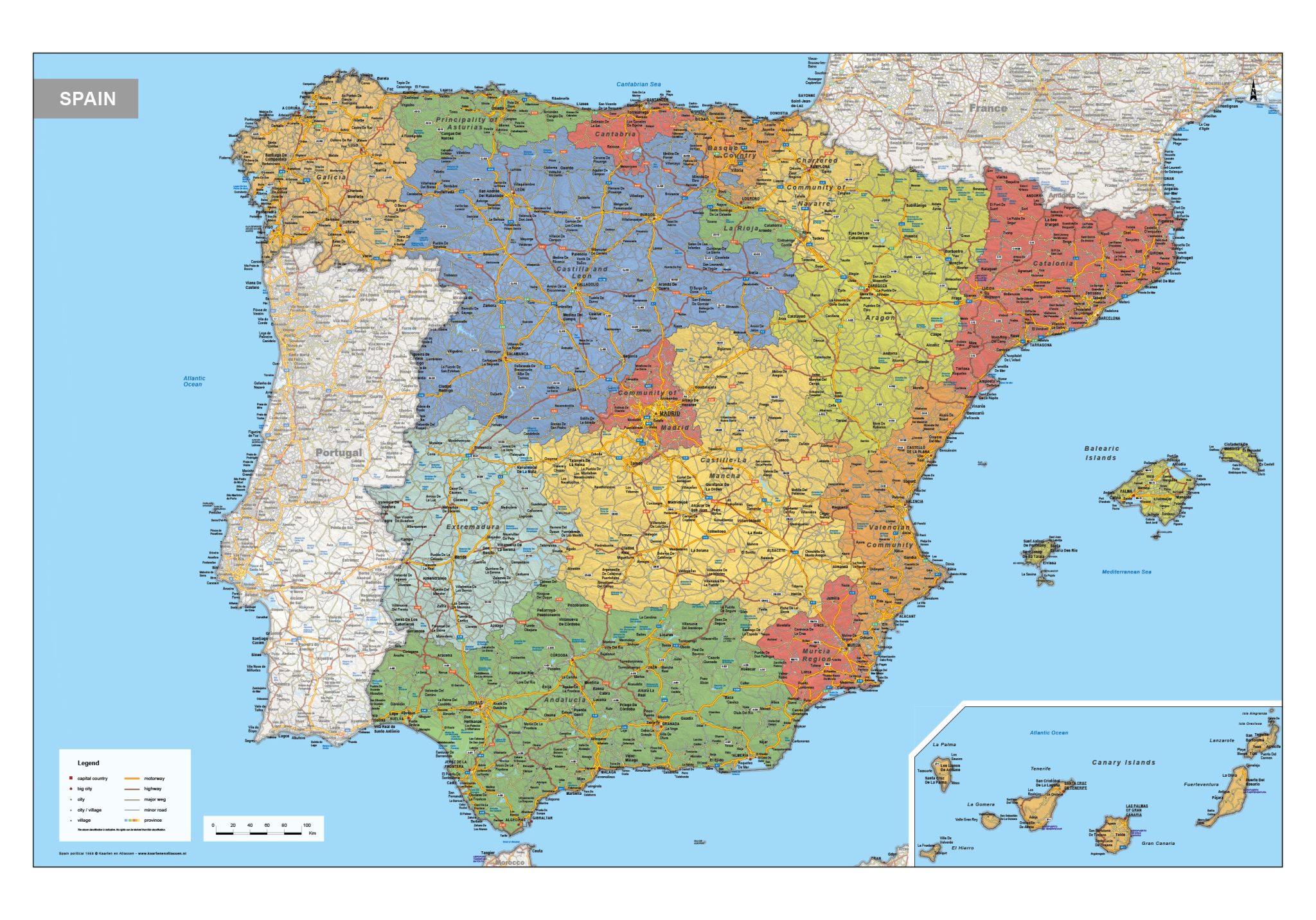
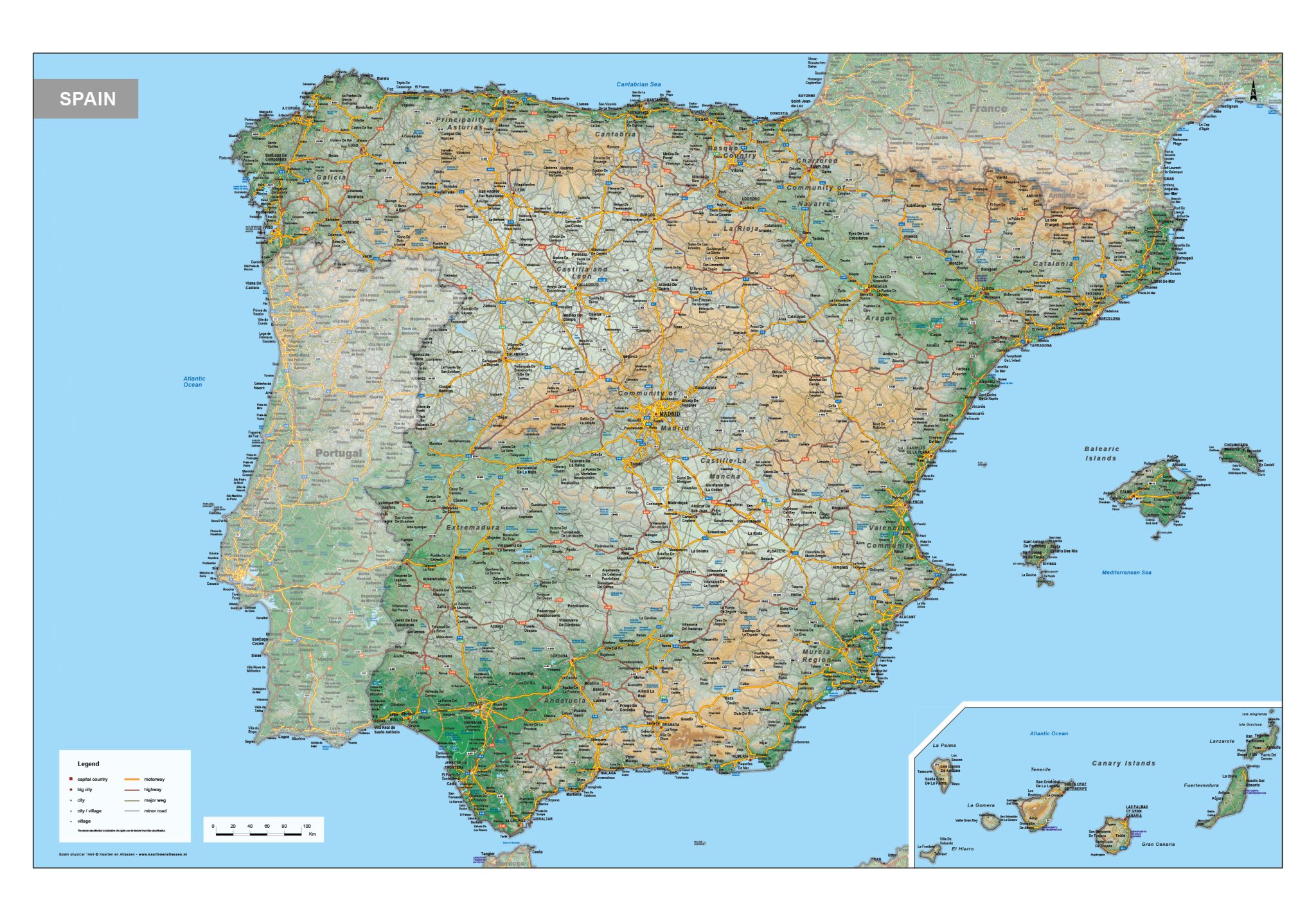
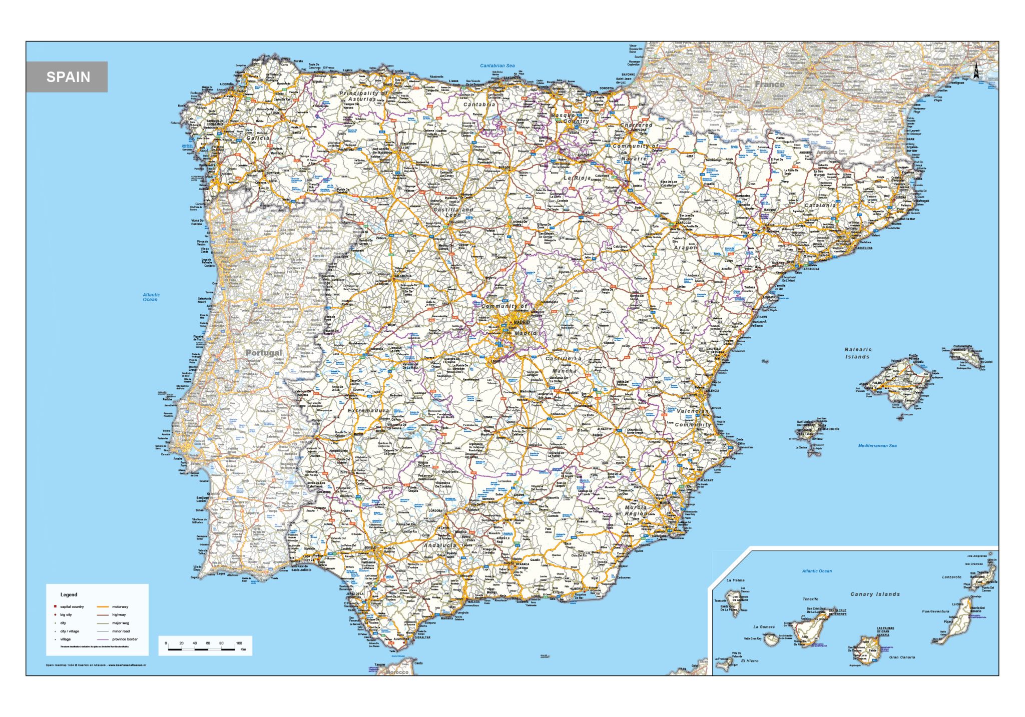
This category includes a broad selection of maps of Spain, featuring political, physical and road map views. Political maps highlight national and regional boundaries, reflecting Spain’s administrative structure. Physical maps focus on terrain and natural features such as mountain ranges, plateaus and river systems. Road maps present the main transport network, including highways and regional routes linking cities and regions across the country.
Together, these maps provide a clear and informative overview of Spain’s geography, suitable for professional reference, planning and educational applications.
Professional, high-resolution vector files (EPS & JPG)
Accurate cartography across multiple projections
Suitable for education, publishing, design and research
Available in various styles: detailed, pastel, modern, scientific
More than 30 years of experience in cartographic production
Custom modifications available
If you need a map with specific colours, labels, languages or custom details, feel free to contact us at info@theworldofmaps.com — we’re happy to help.