High-quality vector downloads (EPS & JPG) for professional use
Clear overviews of postal code areas
This category contains digital postal code maps, designed to present postal code areas in a clear and structured way. Postal zones are shown with numeric labels, making the maps suitable for geographic analysis, planning and operational use. Both two-digit and four-digit postcode structures are represented, depending on the map. The collection focuses on clarity, consistency and professional usability for applications where postal divisions play an important role.
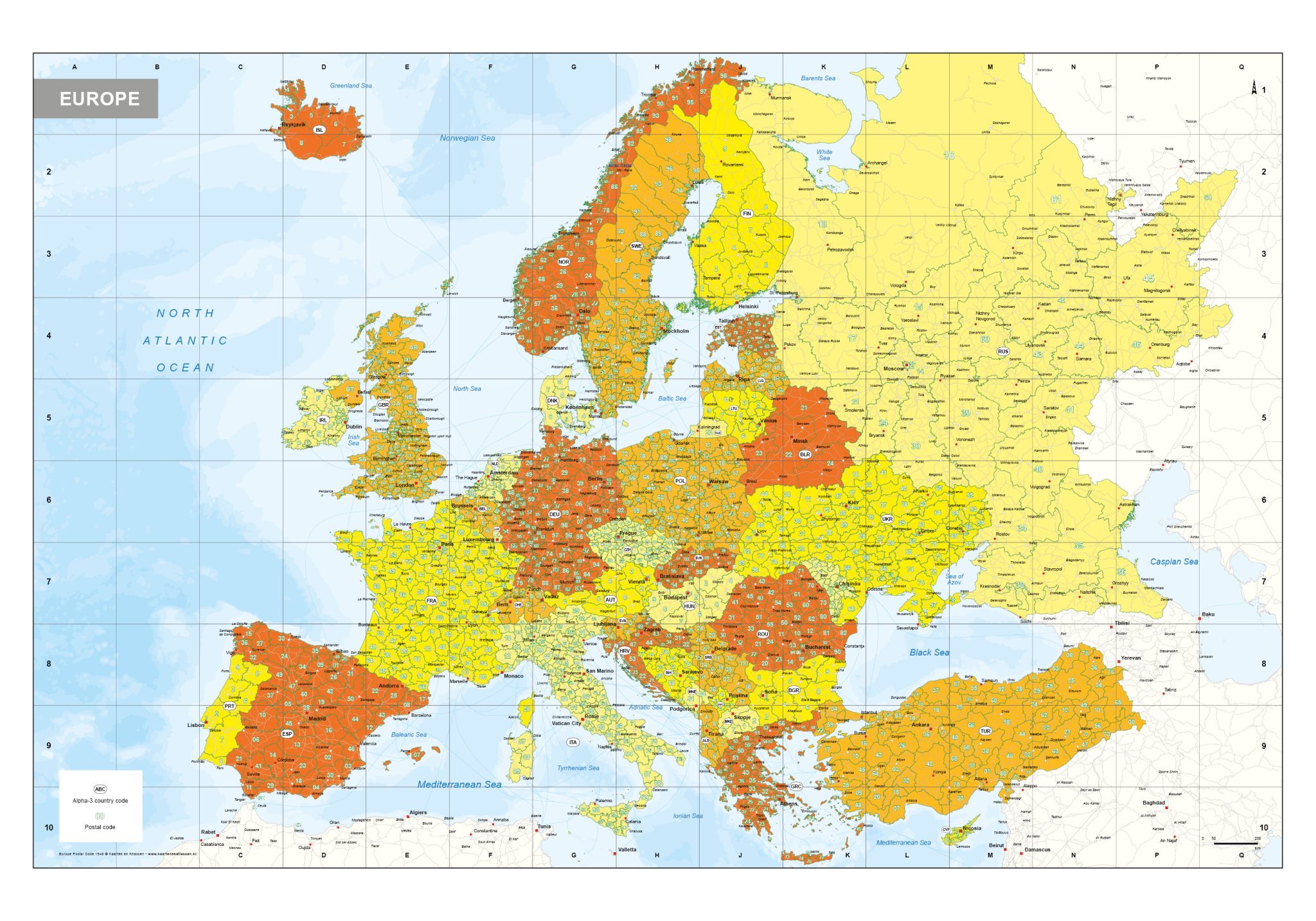
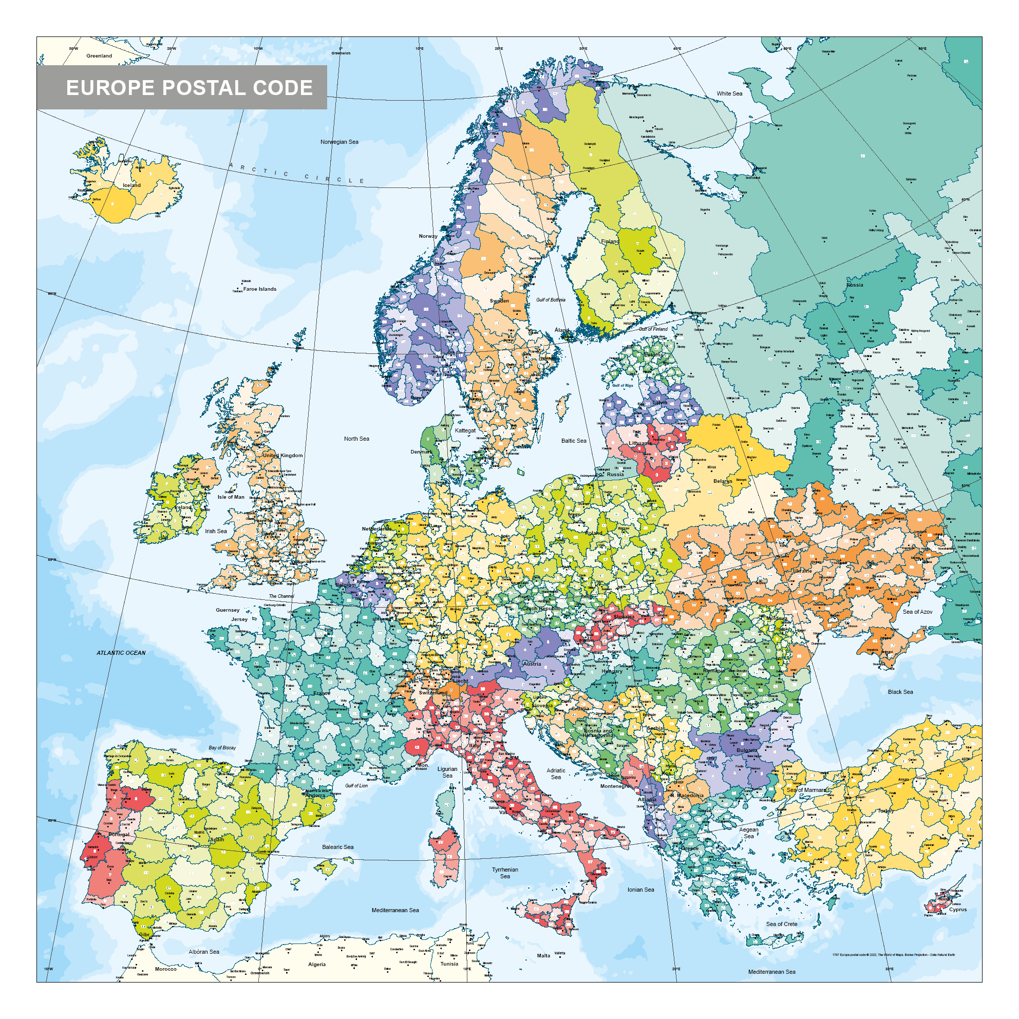
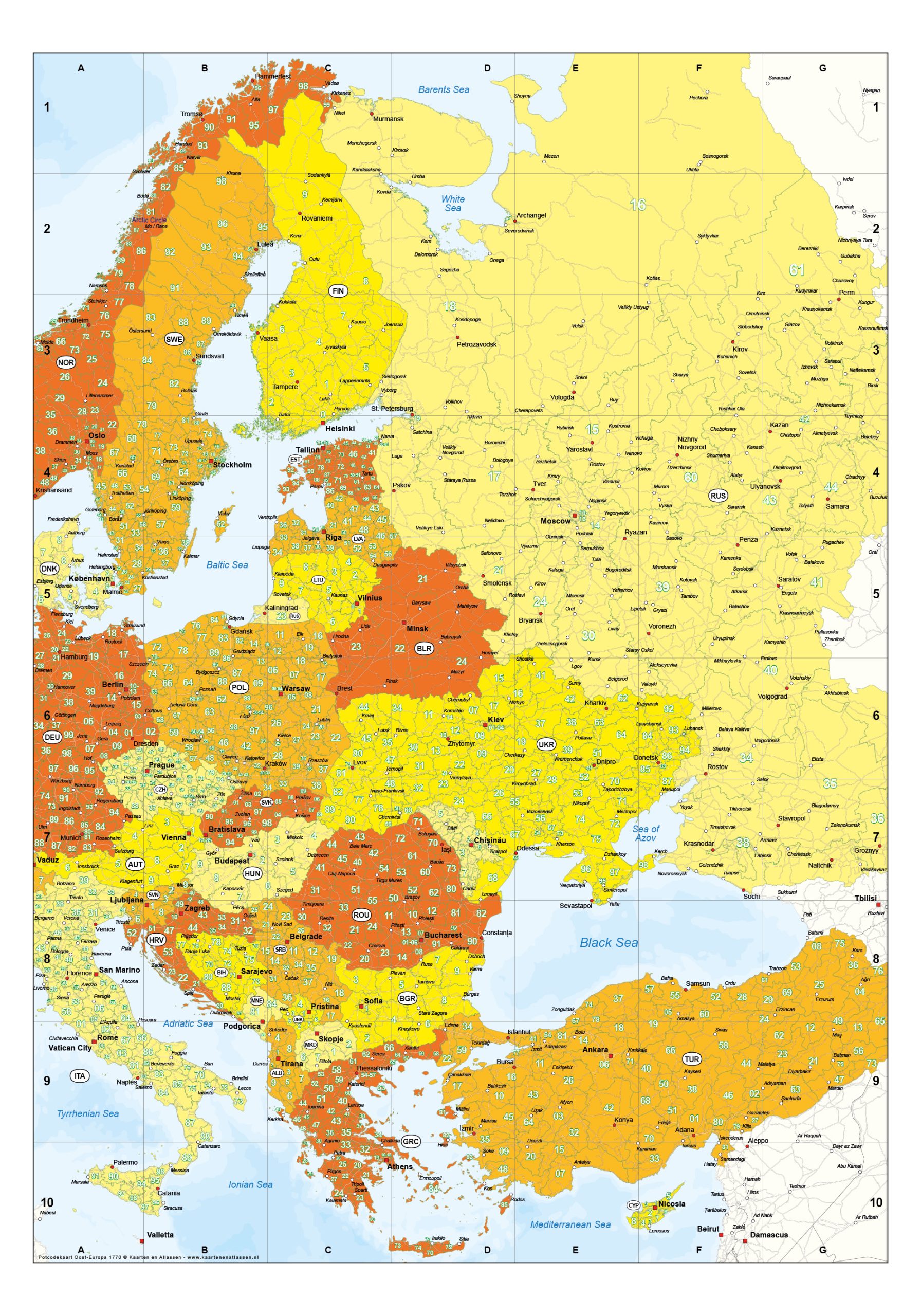
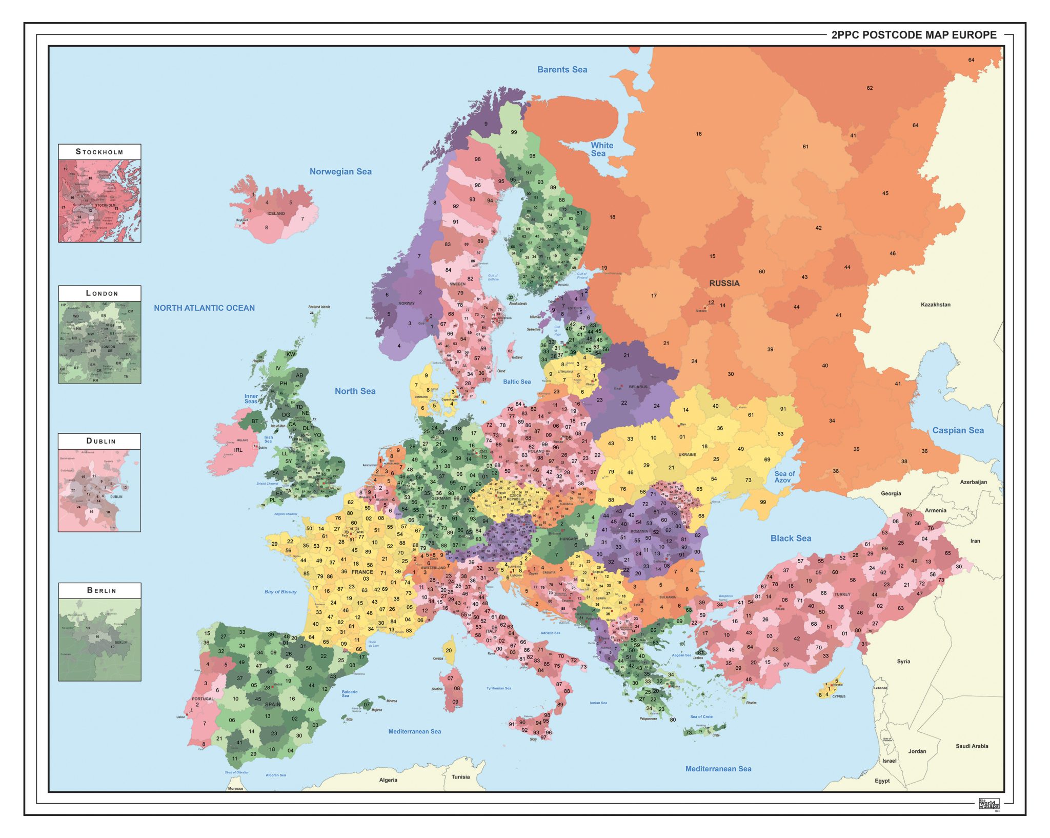
Postal code Maps – Two-Digit and Four-Digit Structures
Our postal code maps provide an efficient way to visualise postal code areas at different levels of detail. Whether you need a broad regional overview or a more detailed subdivision, each map is designed to remain readable while clearly defining postcode boundaries.
Available Postal code Types
Two-Digit Postal code Maps Offer a high-level overview of larger postal regions, often used for strategic planning and regional analysis.
Four-Digit Postal code Maps Provide a more detailed subdivision of postal areas, suitable for logistics, distribution planning and market analysis.
Professional Digital Files
All postal code maps are supplied as EPS & JPG downloads, ensuring flexibility across different use cases:
scalable without loss of quality
suitable for large-format printing
ideal for design, planning and analytical use
compatible with professional design software
Practical Applications
Postal code maps are widely used for defining service areas, delivery zones and sales regions. Their clear numeric structure makes them particularly effective for logistics, distribution networks and geographic data visualisation.
Why Choose Our Postal code Maps
✔ High-quality EPS & JPG digital downloads ✔ Clear representation of postcode boundaries ✔ Suitable for logistics, planning and analysis ✔ Consistent cartographic style and readability ✔ Designed for professional and operational use