High-quality vector downloads (EPS & JPG) for professional use
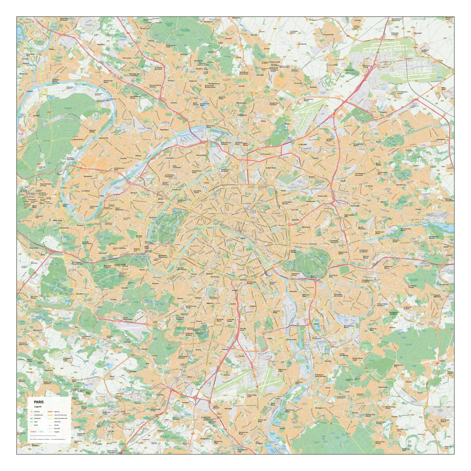
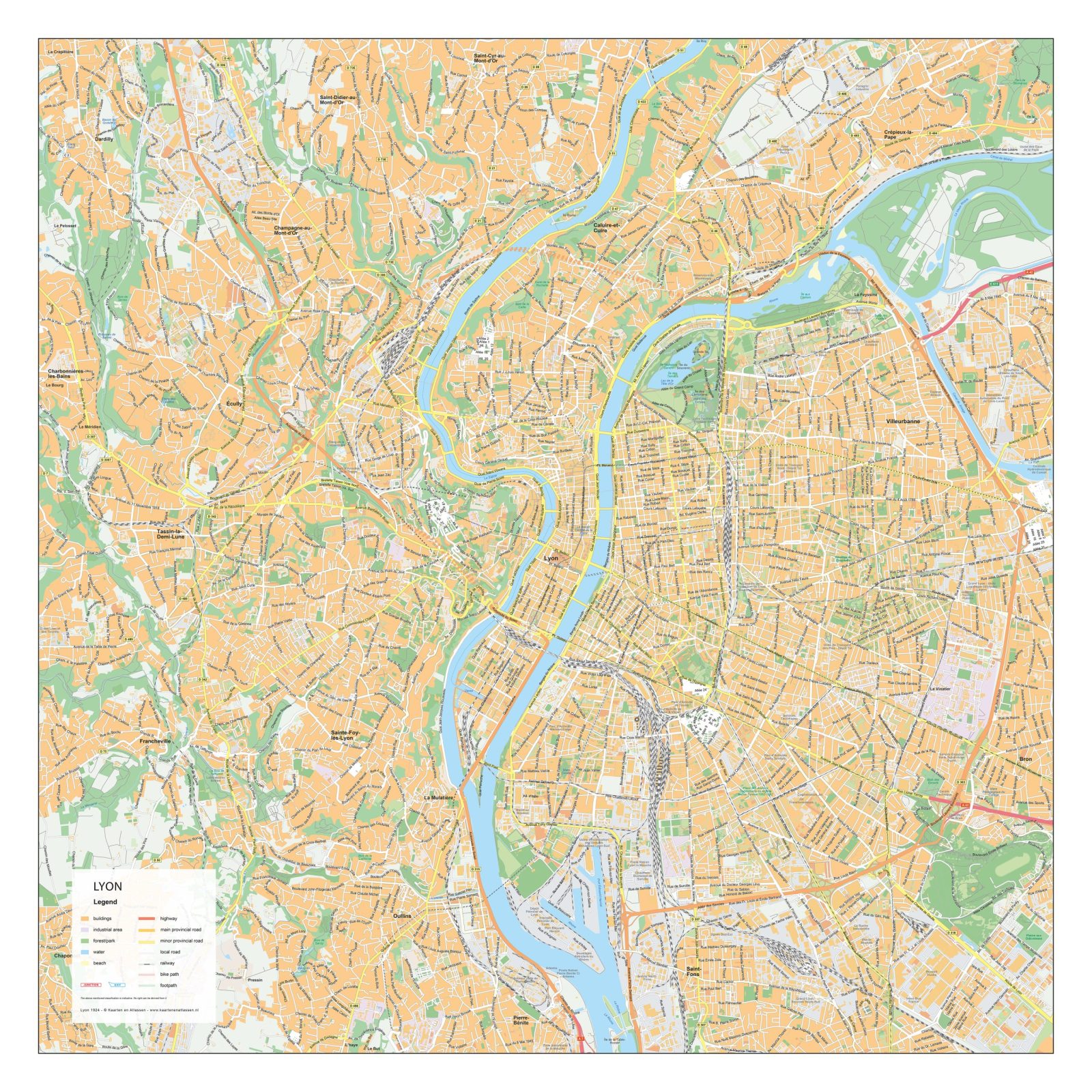
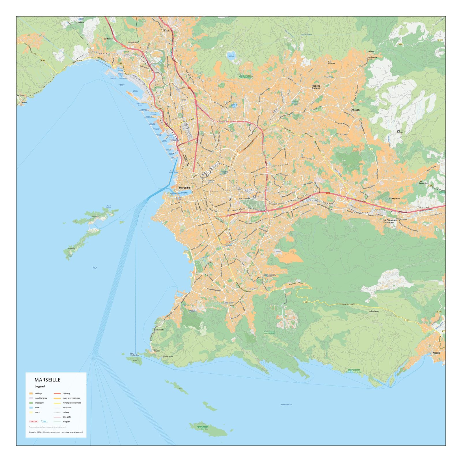
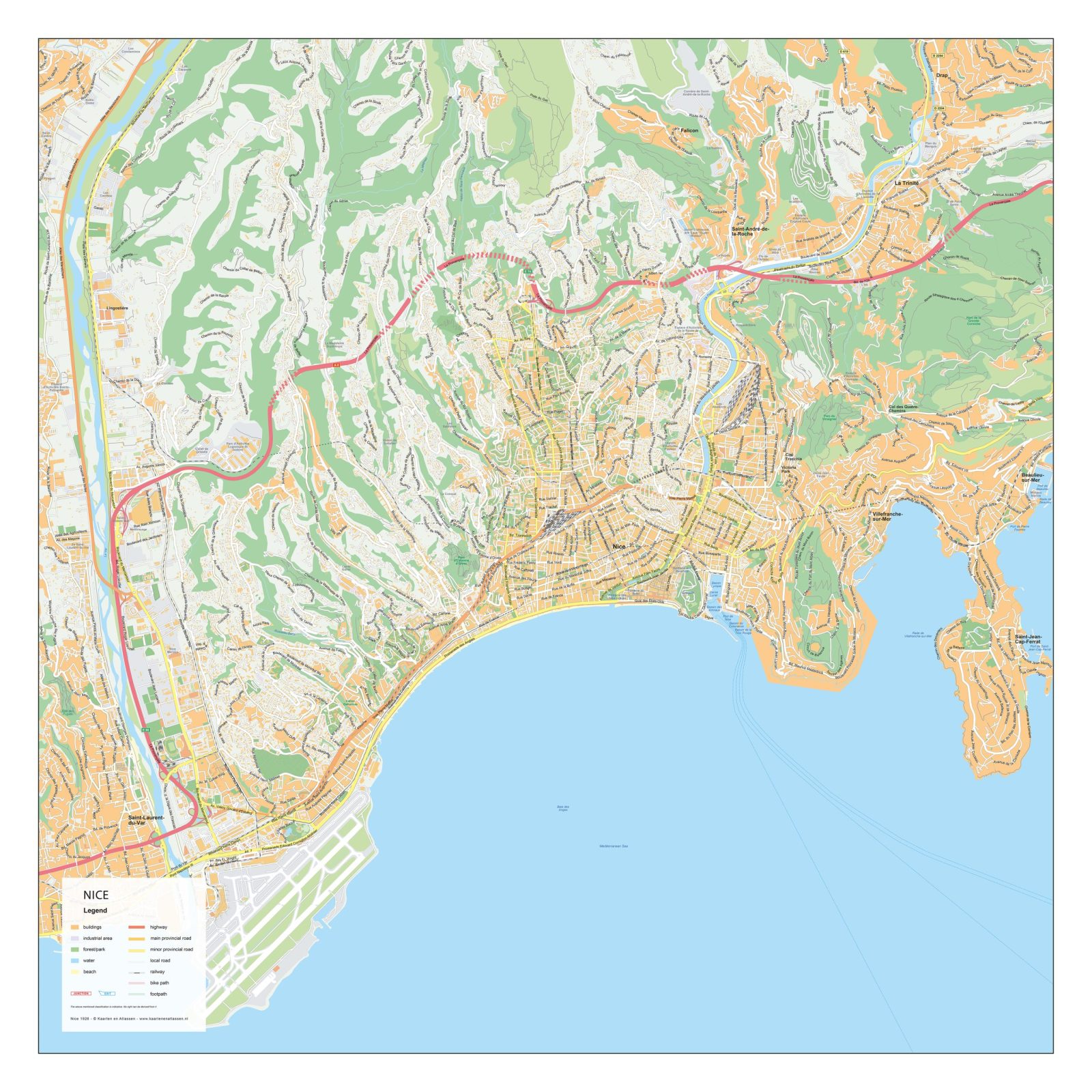
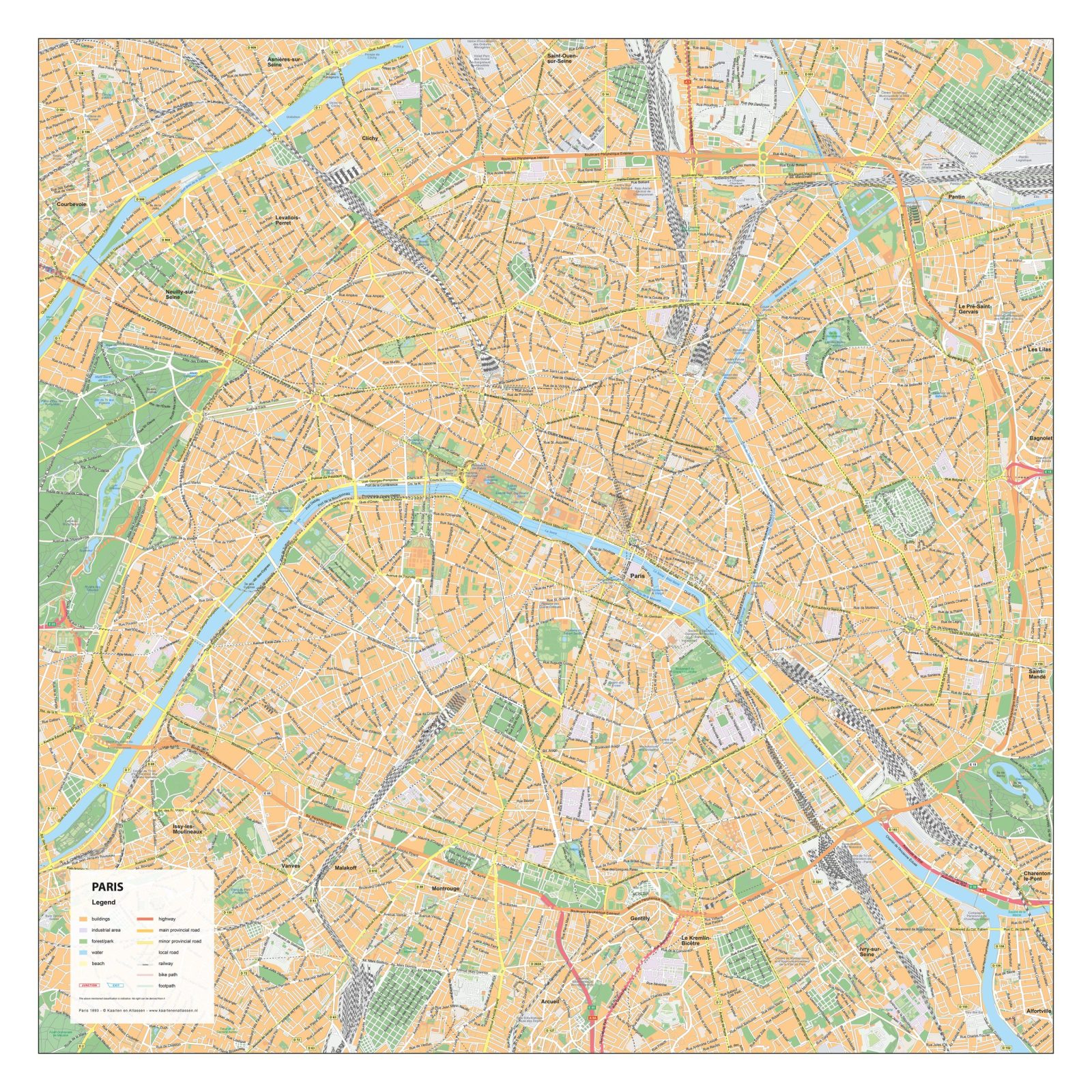
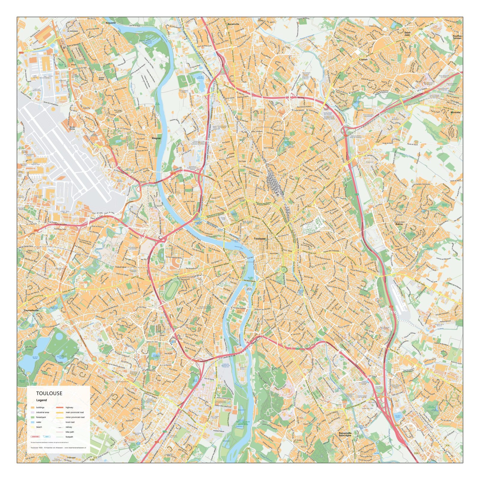
This section presents a collection of detailed city maps of French cities, showing their urban structure with clarity and precision. Streets, squares, rivers, parks and key neighbourhoods are clearly represented, offering an accurate overview of both historic centres and surrounding districts.
The maps focus on clean cartographic design and strong readability, making them suitable for professional, educational and creative applications. Each city plan highlights the distinct layout and character of French cities, from compact historic cores to more extensive urban areas, all presented in a consistent and well-balanced visual style.
Suitable for education, publishing, design and research
Available in various styles: detailed, pastel, modern, scientific
More than 30 years of experience in cartographic production
Custom modifications available
Need a Custom Map?
If you need a map with specific colours, labels, languages or custom details, feel free to contact us at info@theworldofmaps.com — we’re happy to help.