- Delivered as EPS & JPG
- High-quality downloads
- Over 30 years of experience
✅ Diverse formaten
✅ Niet goed, geld terug
✅ Meer dan 30 jaar ervaring
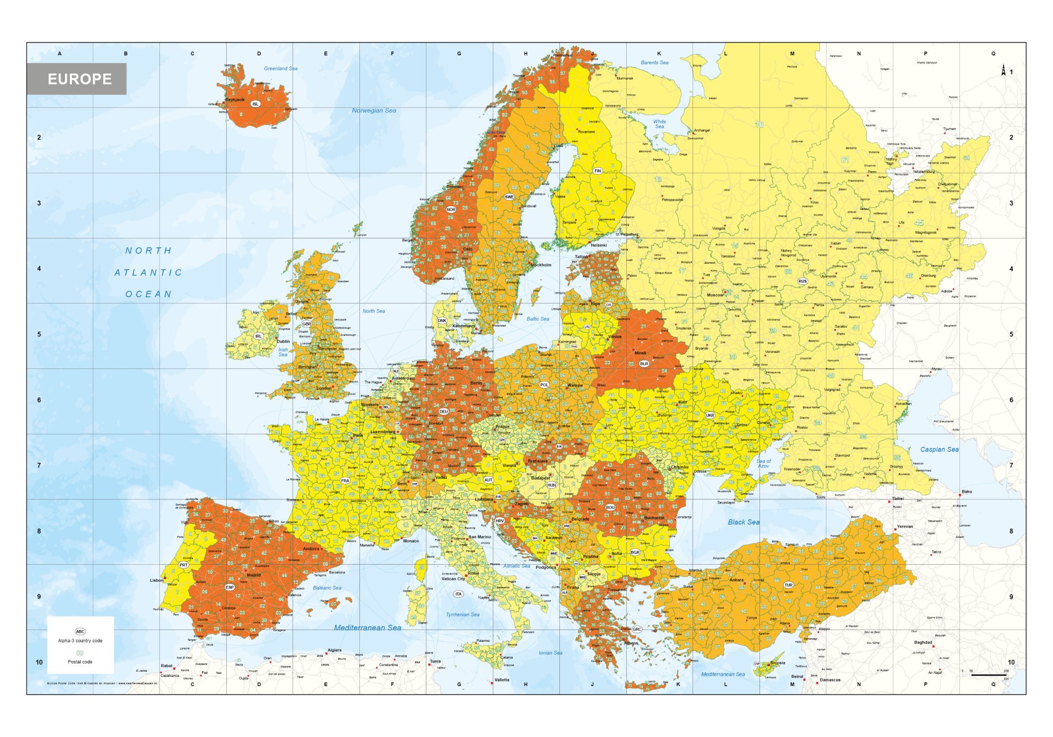
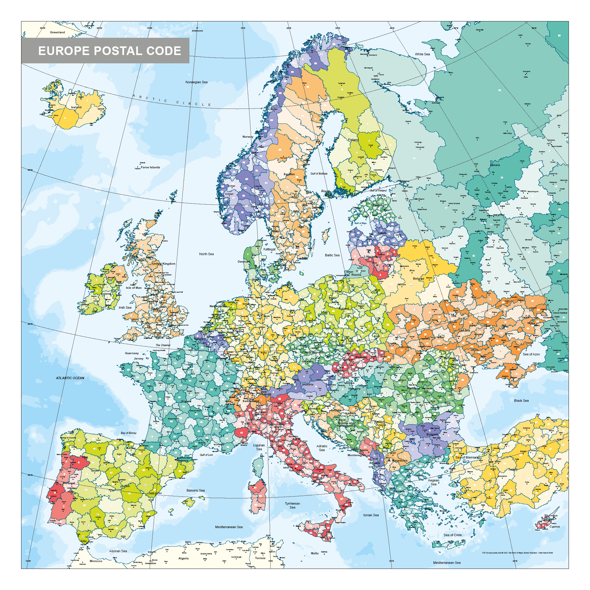
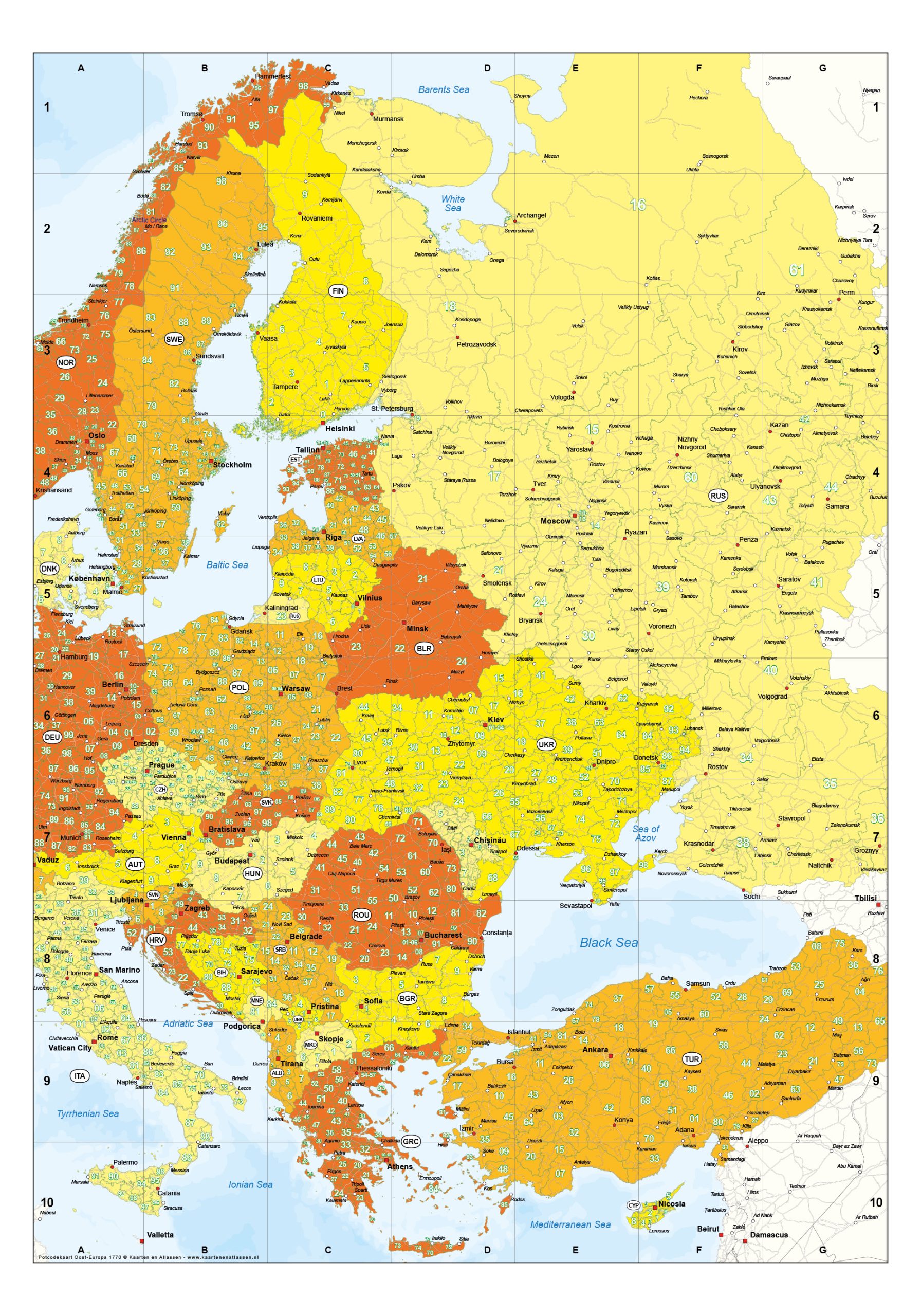
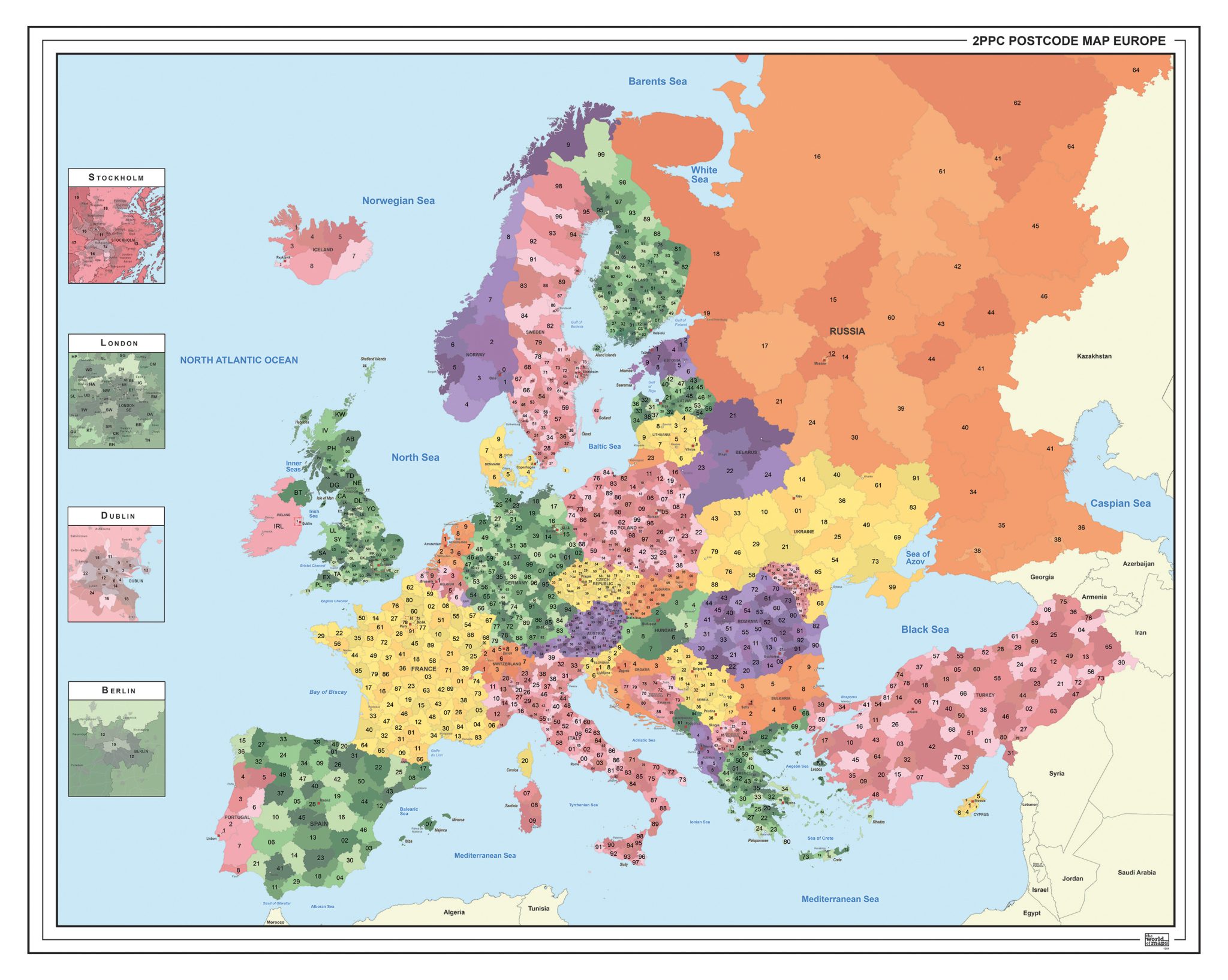
This collection presents Europe divided into two-digit postal code areas, displayed using clear and contrasting colour zones. Each region is visually separated, making national and cross-border postcode structures easy to interpret at a glance.
The maps are available in multiple layouts, including portrait, landscape and square formats, allowing for different visual preferences and applications. Several editions can also be supplied as digital files, offering additional flexibility in use. Different visual executions are available within the series, providing clear and structured overviews of European postal code regions.
Professional, high-resolution vector files (EPS & JPG)
Accurate cartography across multiple projections
Suitable for education, publishing, design and research
Available in various styles: detailed, pastel, modern, scientific
More than 30 years of experience in cartographic production
Custom modifications available
If you need a map with specific colours, labels, languages or custom details, feel free to contact us at info@theworldofmaps.com — we’re happy to help.