- Delivered as EPS & JPG
- High-quality downloads
- Over 30 years of experience
✅ Diverse formaten
✅ Niet goed, geld terug
✅ Meer dan 30 jaar ervaring
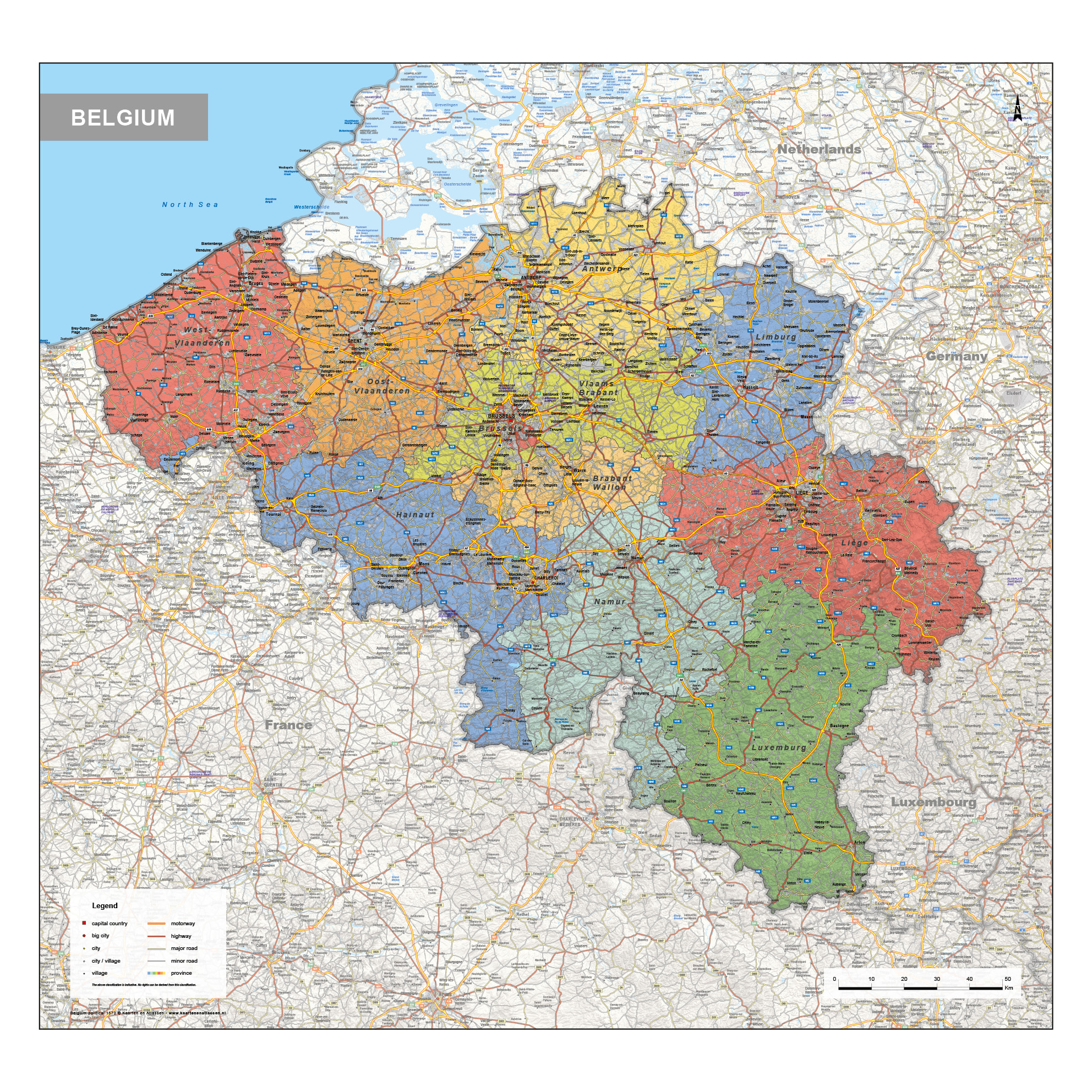
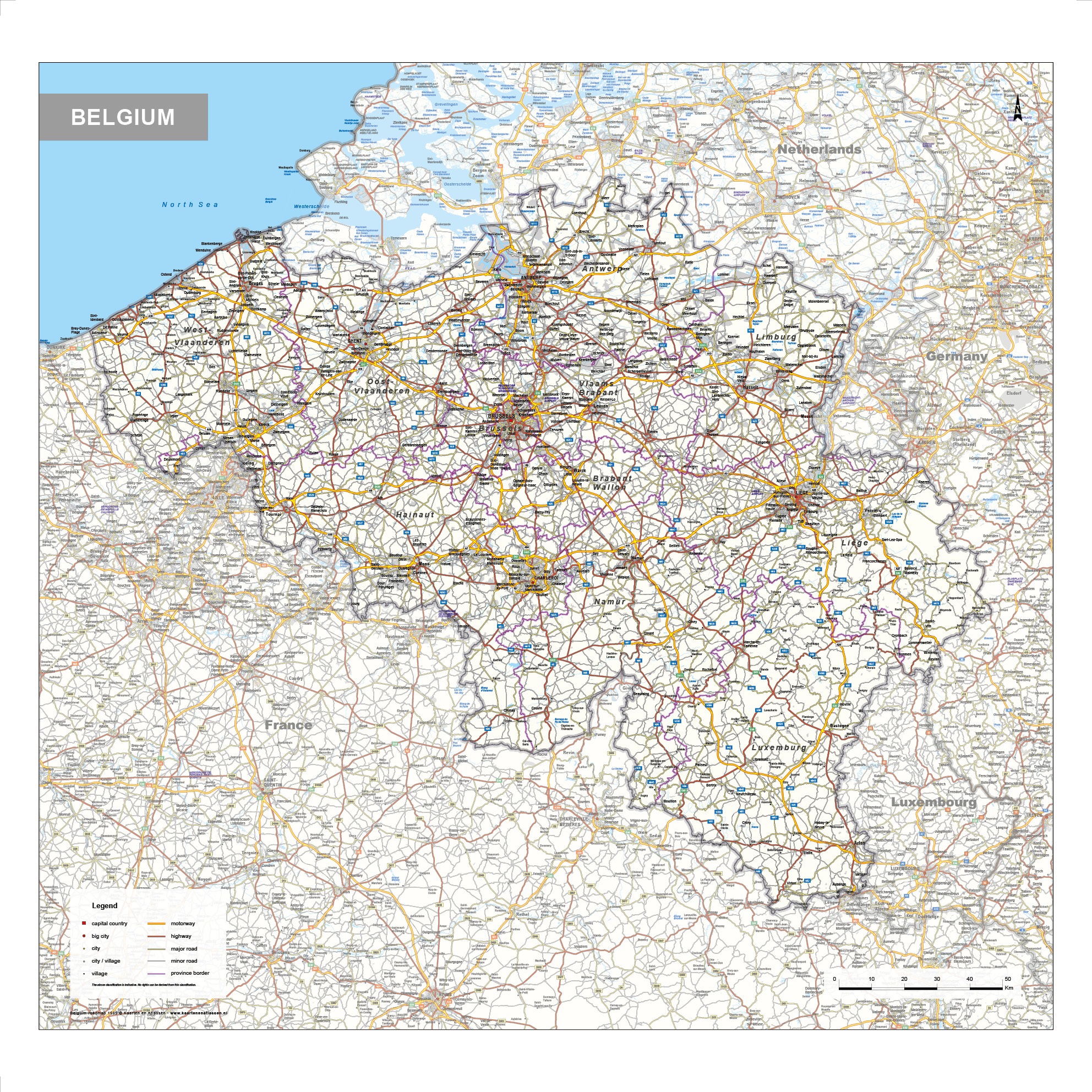
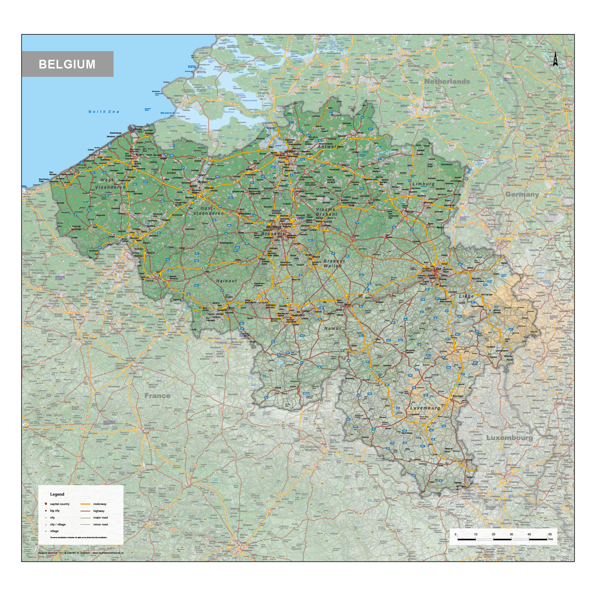
This category presents a focused collection of detailed maps of Belgium, covering political, physical and road-based perspectives. Political maps highlight national and regional boundaries, including provinces and major administrative divisions. Physical maps emphasise landscape features such as elevation, river systems and lowland areas, offering a clear view of Belgium’s natural geography. Road maps provide an overview of highways, secondary roads and key transport routes, with many cities and towns clearly indicated.
The maps are designed for professional reference, planning and educational use, combining accuracy with a clear visual structure. Together, these map types offer a well-rounded geographic overview of Belgium from multiple perspectives.
Professional, high-resolution vector files (EPS & JPG)
Accurate cartography across multiple projections
Suitable for education, publishing, design and research
Available in various styles: detailed, pastel, modern, scientific
More than 30 years of experience in cartographic production
Custom modifications available
If you need a map with specific colours, labels, languages or custom details, feel free to contact us at info@theworldofmaps.com — we’re happy to help.