- Delivered as EPS & JPG
- High-quality downloads
- Over 30 years of experience
✅ Diverse formaten
✅ Niet goed, geld terug
✅ Meer dan 30 jaar ervaring
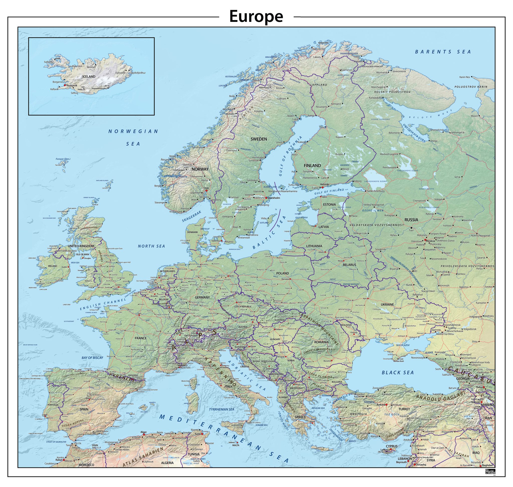
Physical world maps show the natural features of the Earth in clear and detailed form. These maps typically use colour gradients based on elevation: green for lowlands, yellow to brown for higher terrain, and white for mountain peaks. They highlight landforms, water systems and global patterns that shape our planet. Some editions also include additional information such as ocean currents, tectonic fault lines, climate zones and major landforms. Whether you need a simple and clean design or a highly detailed scientific edition, our collection offers multiple styles and visual approaches.All maps are available as high-quality EPS & JPG digital vector downloads, suitable for print, design, education and professional use. Custom sizes or alternative formats can be delivered on request.
Professional, high-resolution vector files (EPS & JPG)
Accurate cartography across multiple projections
Suitable for education, publishing, design and research
Available in various styles: detailed, pastel, modern, scientific
More than 30 years of experience in cartographic production
Custom modifications available
If you need a map with specific colours, labels, languages or custom details, feel free to contact us at info@theworldofmaps.com — we’re happy to help.