High-quality vector downloads (EPS & JPG) for professional use
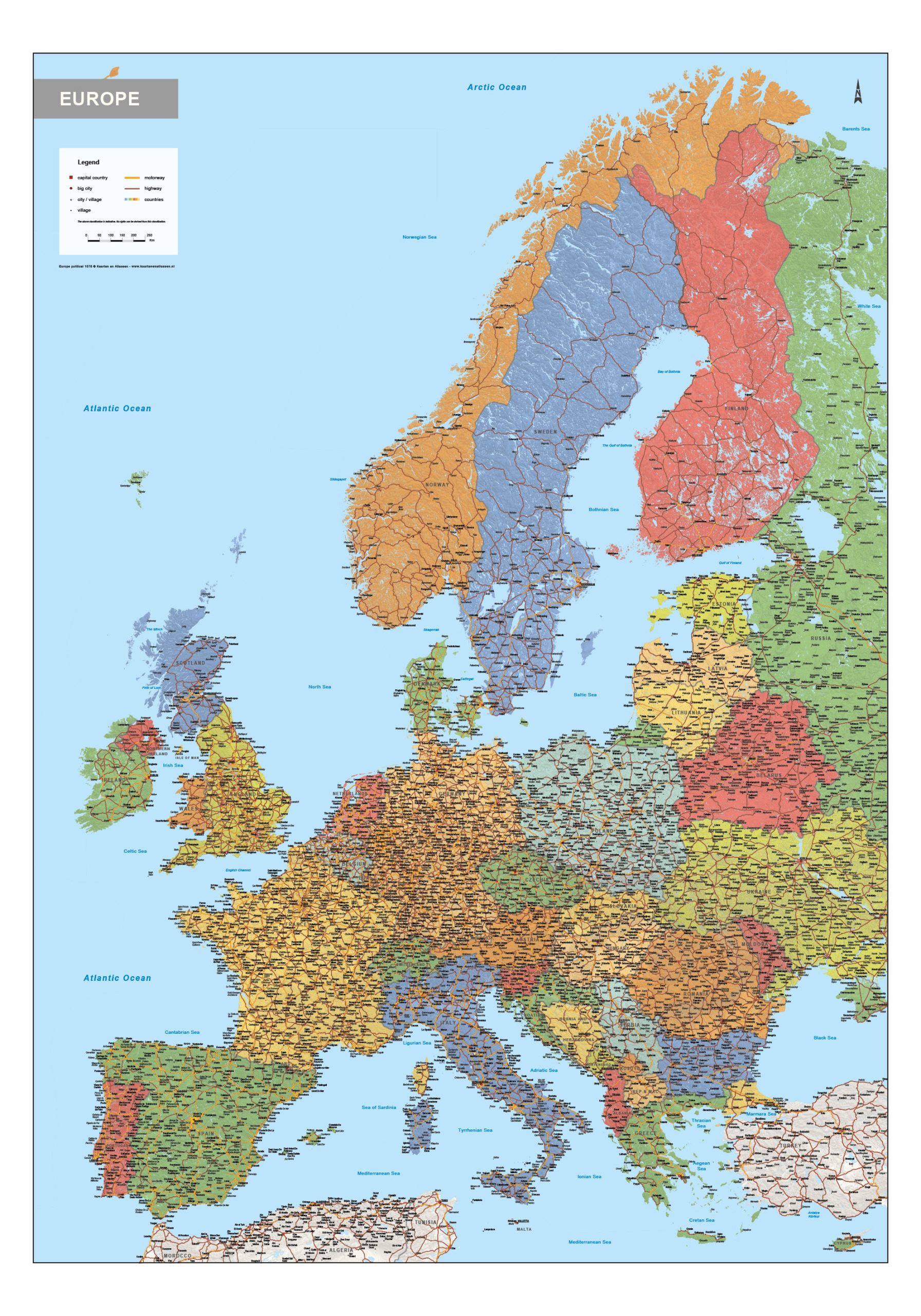
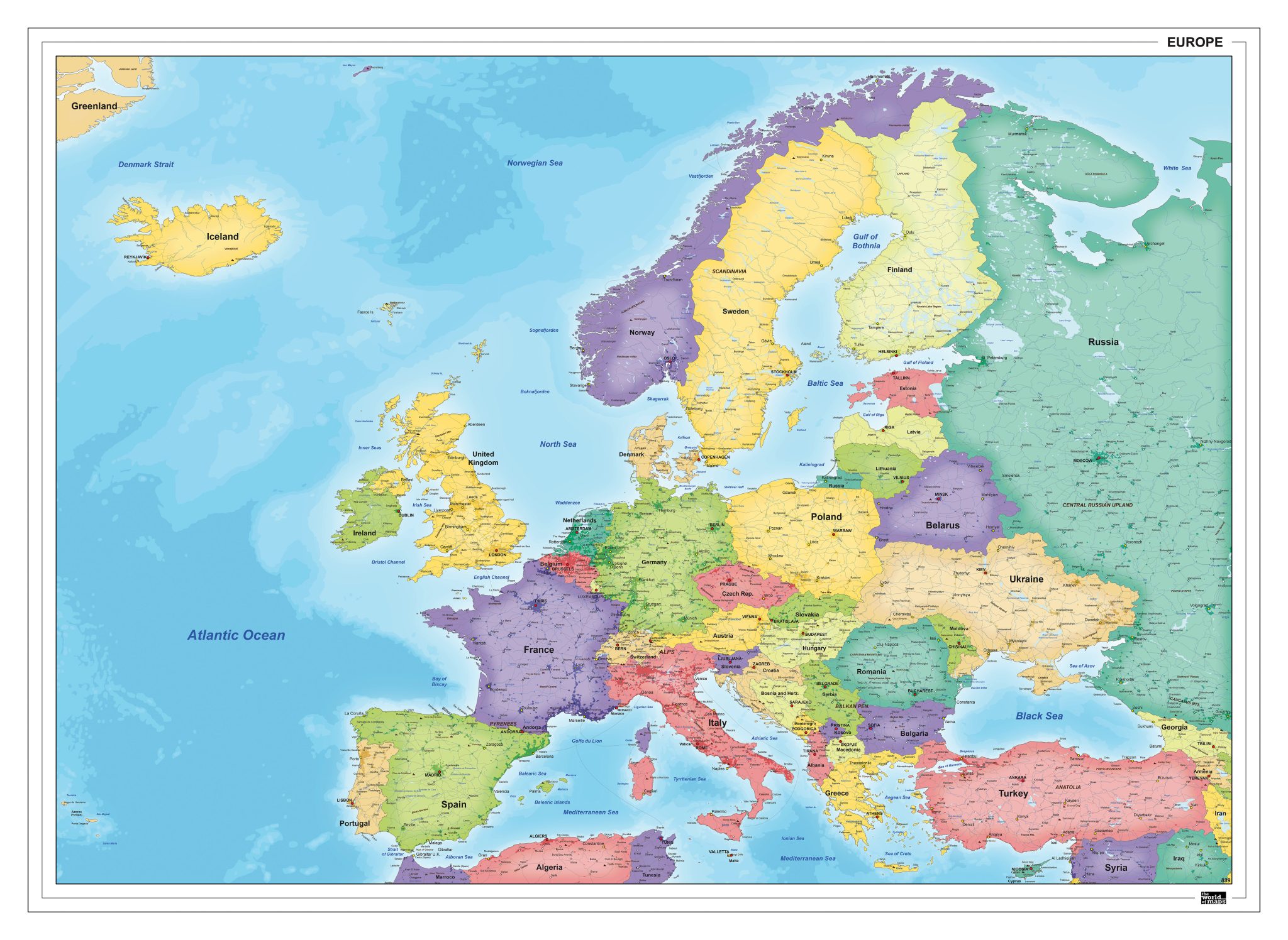
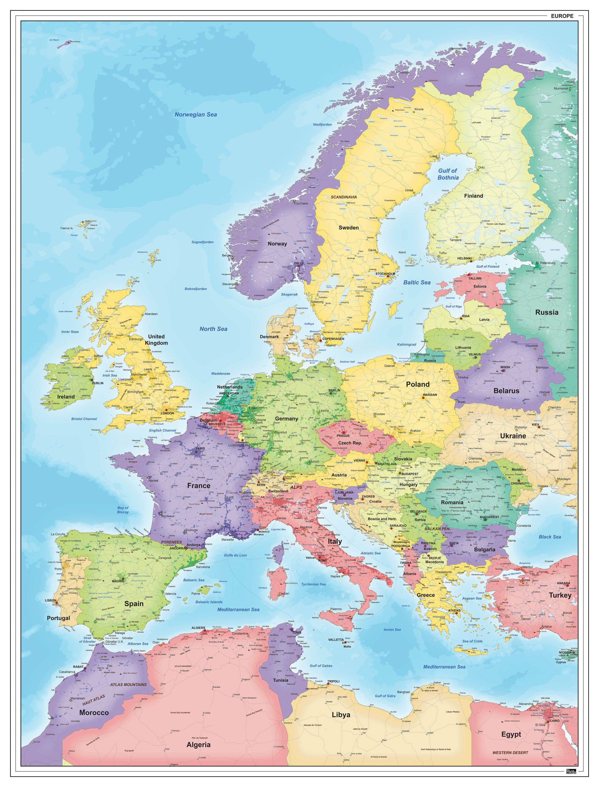
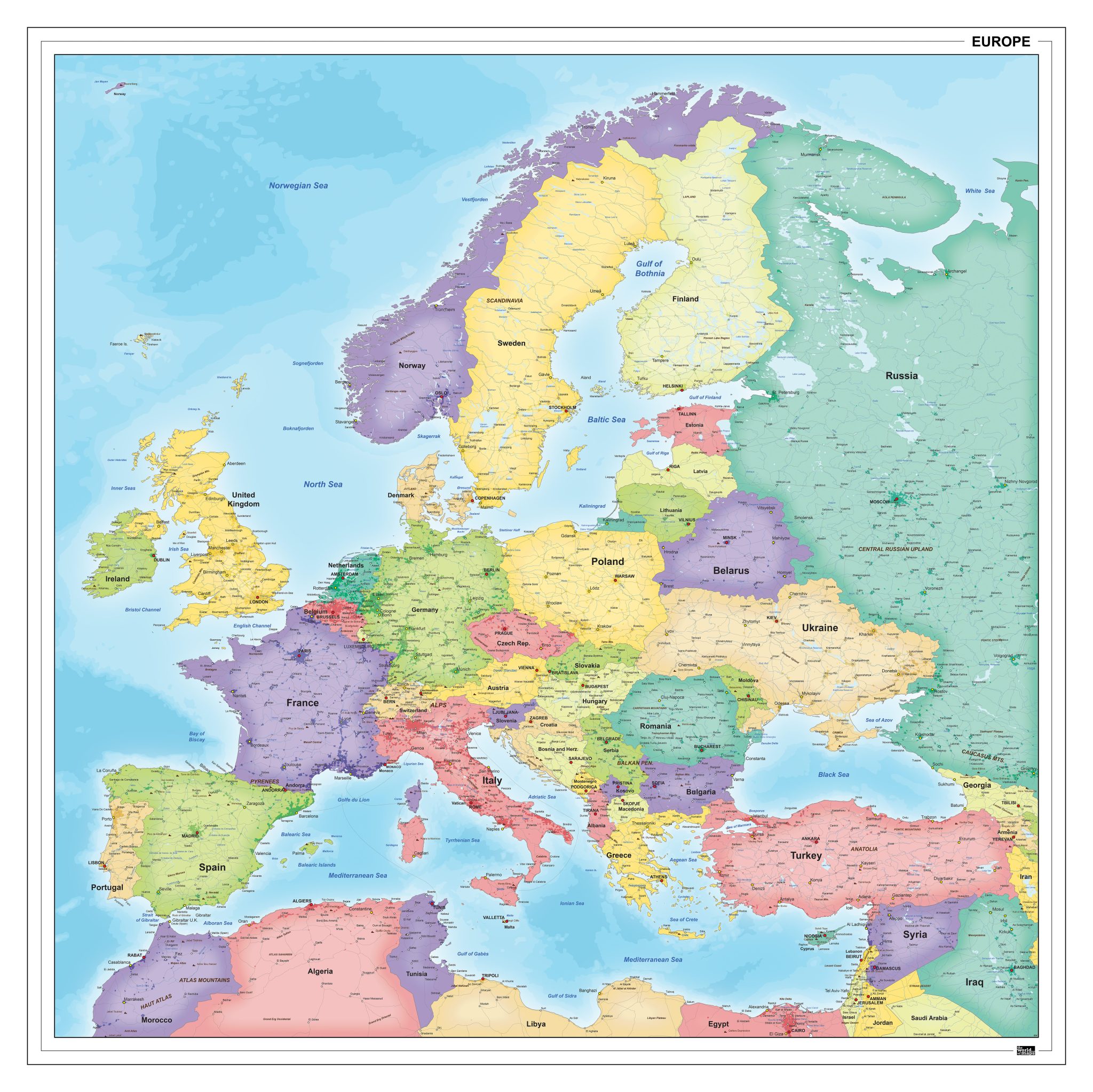
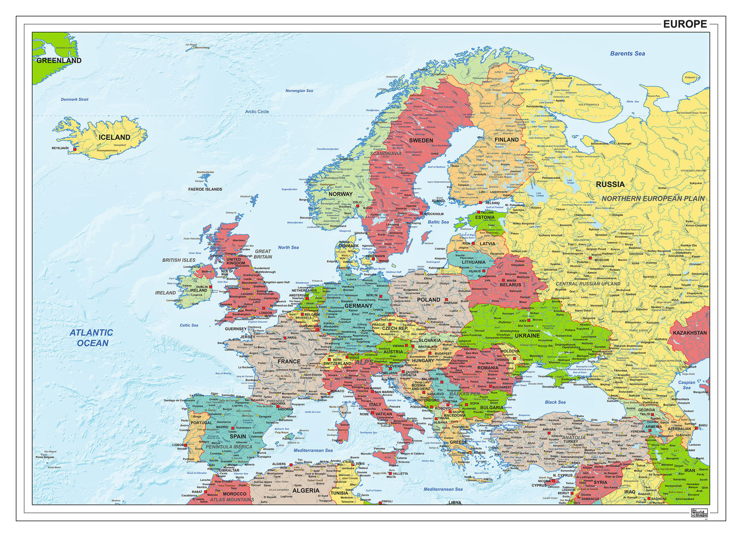
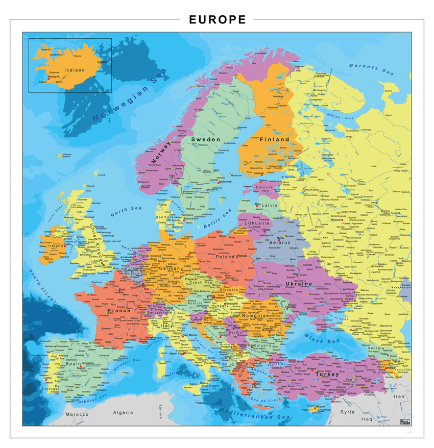
This collection presents a broad selection of political maps of Europe, with a clear focus on national boundaries, country names and capital cities. The maps provide a structured overview of the continent and are available in a range of visual styles, from restrained and minimal designs to highly detailed editions.
Different colour schemes are used to distinguish countries clearly, supporting both clarity and readability. The maps are offered in multiple orientations, including landscape, portrait and square layouts, allowing for varied presentations depending on the level of detail shown. Many of the political maps of Europe in this category are also available as digital files.
Suitable for education, publishing, design and research
Available in various styles: detailed, pastel, modern, scientific
More than 30 years of experience in cartographic production
Custom modifications available
Need a Custom Map?
If you need a map with specific colours, labels, languages or custom details, feel free to contact us at info@theworldofmaps.com — we’re happy to help.