- Delivered as EPS & JPG
- High-quality downloads
- Over 30 years of experience
✅ Diverse formaten
✅ Niet goed, geld terug
✅ Meer dan 30 jaar ervaring
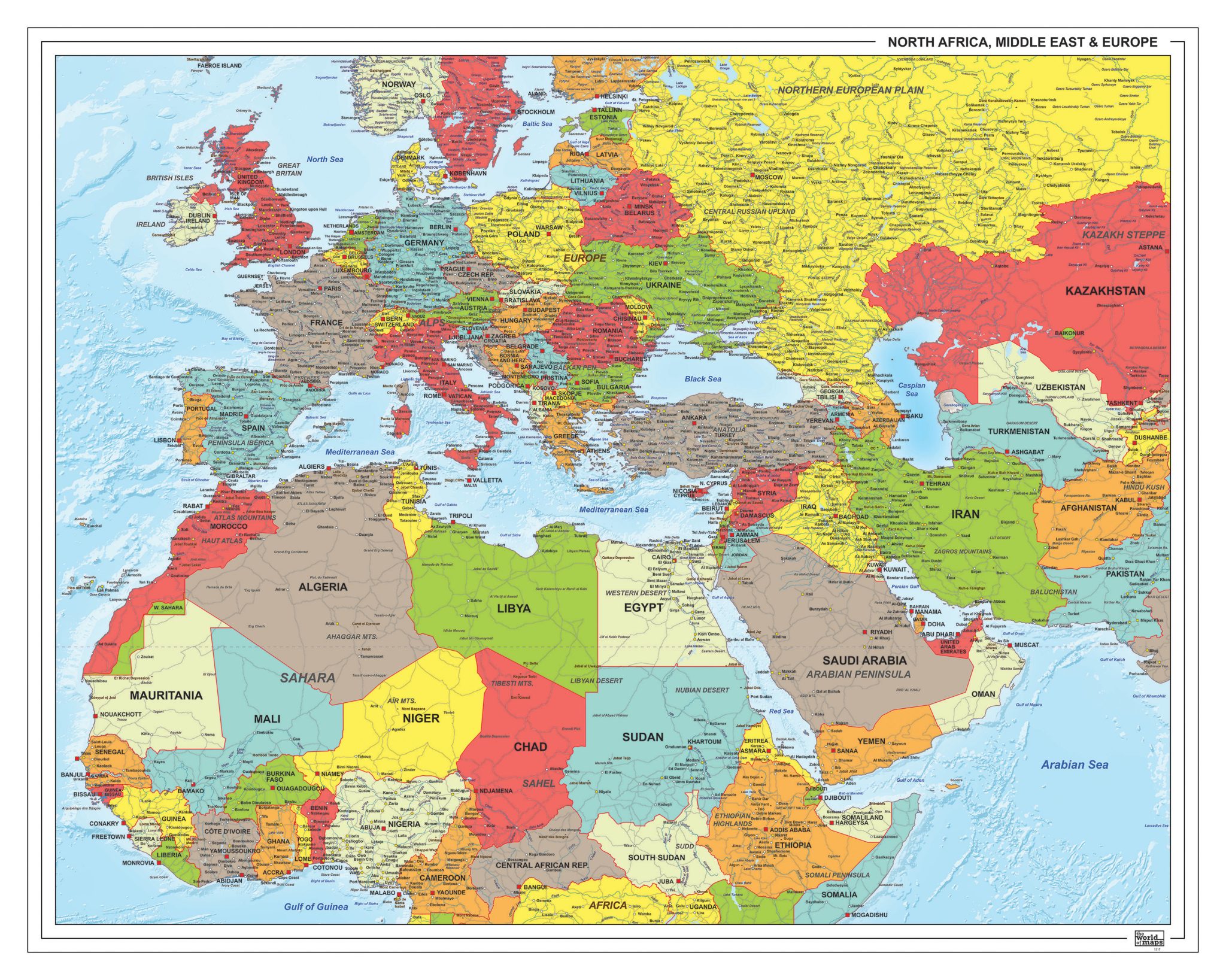
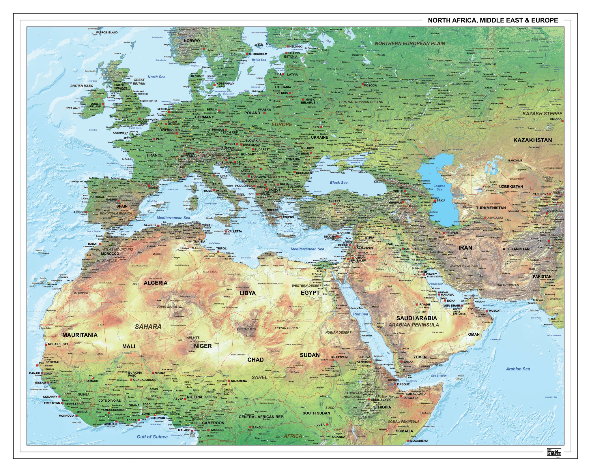
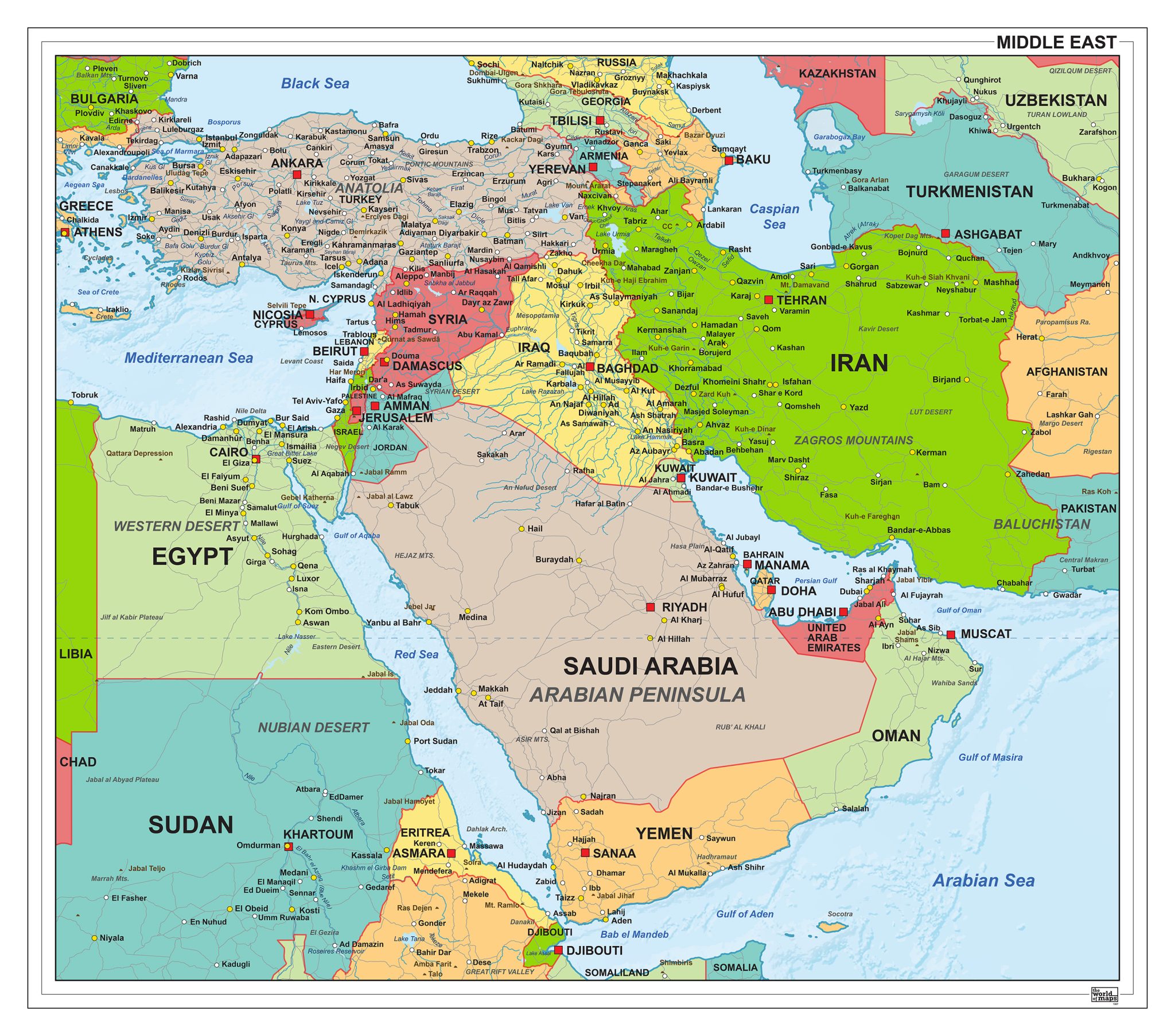
This section features a broad selection of maps focused on the Middle East, one of the most frequently mapped regions in the world. The collection includes political maps that clearly define countries and borders, as well as physical maps highlighting terrain, water systems and geographic structure.
Maps are available in a variety of visual styles and levels of detail, ranging from clean and schematic to richly detailed representations. Different formats and layouts are offered, making the collection suitable for reference, analysis and visual presentation purposes.
Professional, high-resolution vector files (EPS & JPG)
Accurate cartography across multiple projections
Suitable for education, publishing, design and research
Available in various styles: detailed, pastel, modern, scientific
More than 30 years of experience in cartographic production
Custom modifications available
If you need a map with specific colours, labels, languages or custom details, feel free to contact us at info@theworldofmaps.com — we’re happy to help.