- Delivered as EPS & JPG
- High-quality downloads
- Over 30 years of experience
✅ Diverse formaten
✅ Niet goed, geld terug
✅ Meer dan 30 jaar ervaring
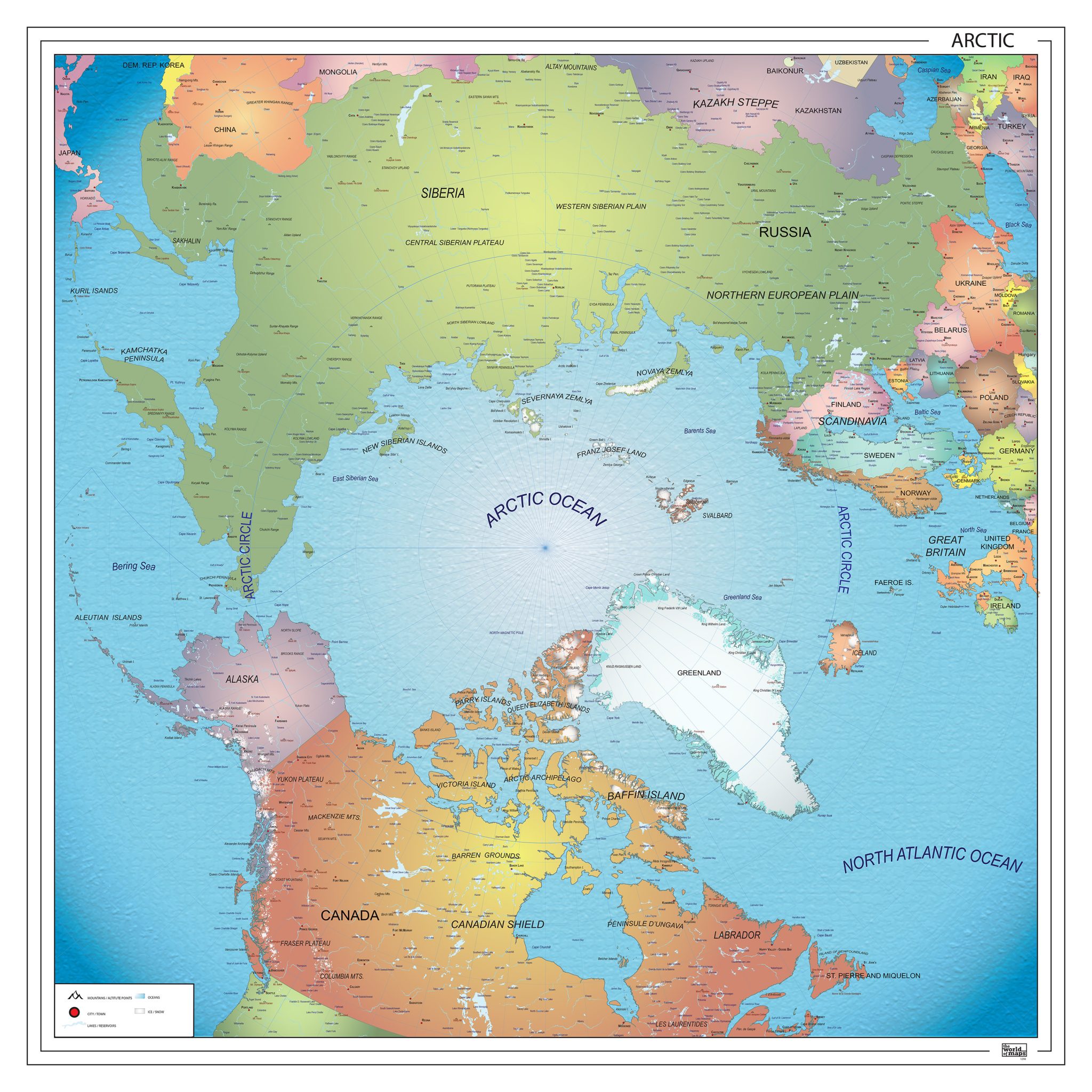
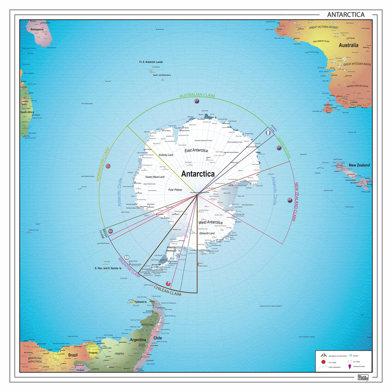
The polar regions are among the most remarkable areas on Earth, and this collection presents them through a range of carefully designed maps of both the Arctic and Antarctica. These maps show ice caps, landforms and surrounding oceans with clear geographic structure and accurate spatial relationships.
The selection includes different visual approaches, from clean overviews to more detailed representations, offering insight into these remote and extreme environments. Many maps in this category are also available as digital files, making them suitable for a wide range of professional and educational applications.
Professional, high-resolution vector files (EPS & JPG)
Accurate cartography across multiple projections
Suitable for education, publishing, design and research
Available in various styles: detailed, pastel, modern, scientific
More than 30 years of experience in cartographic production
Custom modifications available
If you need a map with specific colours, labels, languages or custom details, feel free to contact us at info@theworldofmaps.com — we’re happy to help.