- Delivered as EPS & JPG
- High-quality downloads
- Over 30 years of experience
✅ Diverse formaten
✅ Niet goed, geld terug
✅ Meer dan 30 jaar ervaring
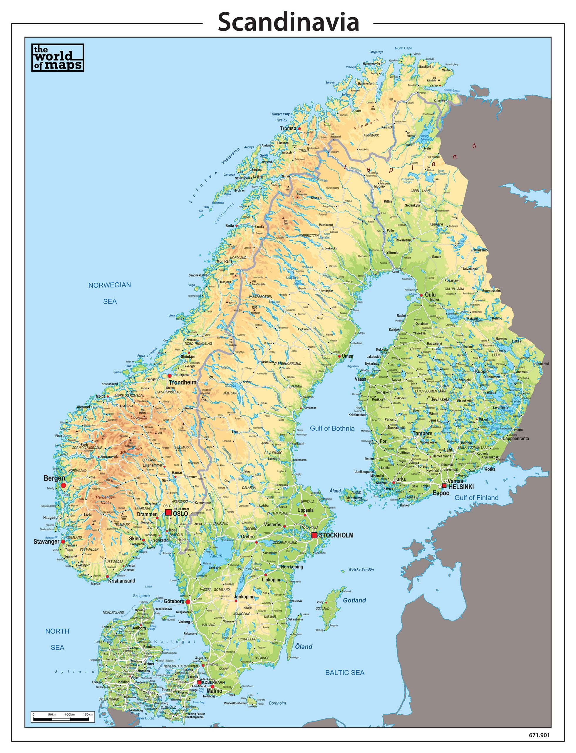
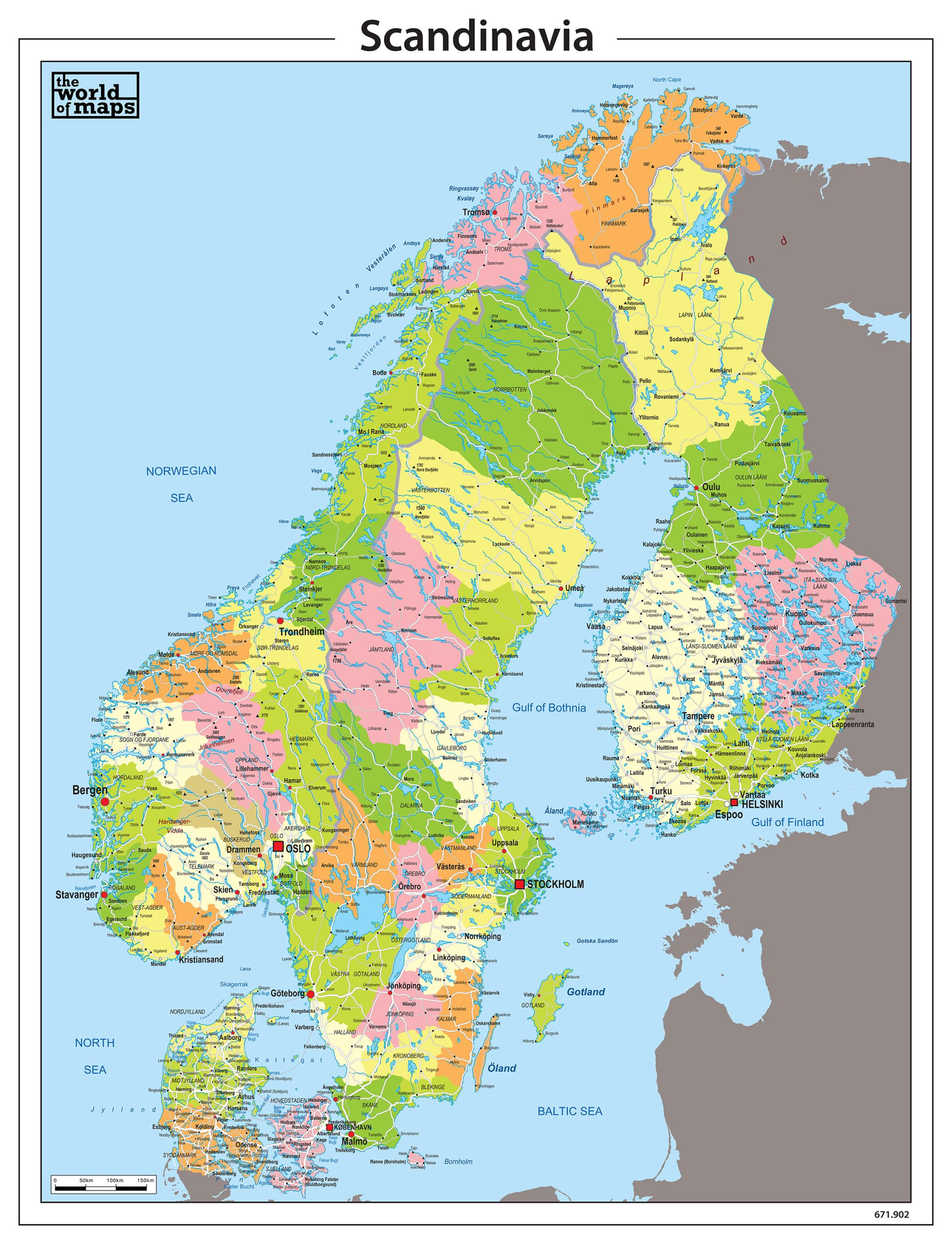
This category presents a collection of maps covering Scandinavia and Northern Europe, including Norway, Sweden and Denmark, often complemented by Finland. Both political maps, highlighting national and regional boundaries, and physical maps, focusing on terrain, waterways and landscape features, are available.
The maps come in a range of visual styles and layouts, from clean and minimalist to more detailed representations. Multiple formats are offered, allowing you to choose the presentation that best suits your purpose.
Professional, high-resolution vector files (EPS & JPG)
Accurate cartography across multiple projections
Suitable for education, publishing, design and research
Available in various styles: detailed, pastel, modern, scientific
More than 30 years of experience in cartographic production
Custom modifications available
If you need a map with specific colours, labels, languages or custom details, feel free to contact us at info@theworldofmaps.com — we’re happy to help.