✅ Diverse formaten ✅ Niet goed, geld terug ✅ Meer dan 30 jaar ervaring

Continental Maps

High-quality vector downloads (EPS & JPG) for professional use

High-quality digital maps of continents and world regions

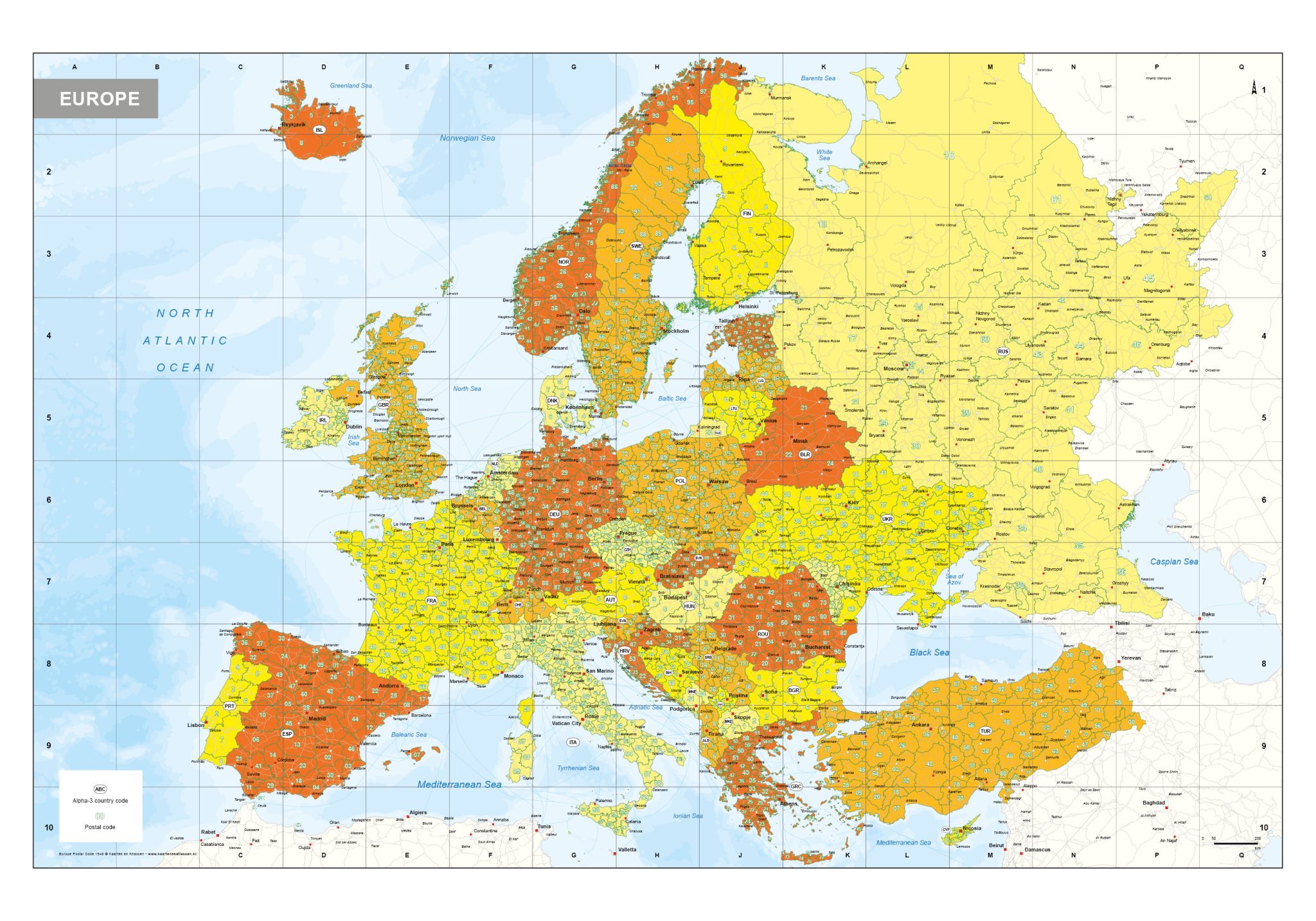
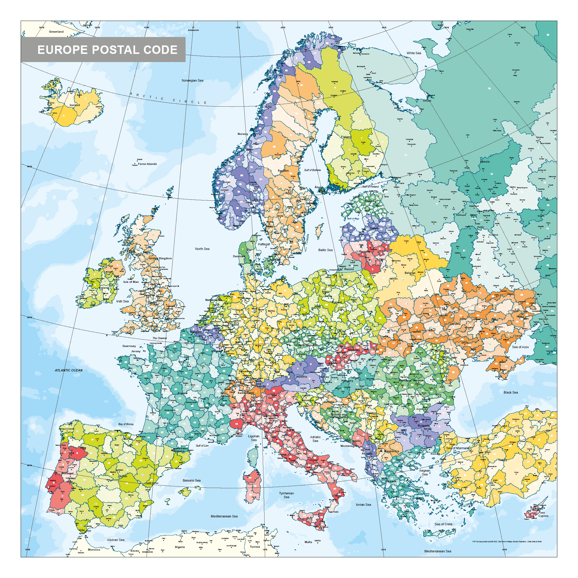
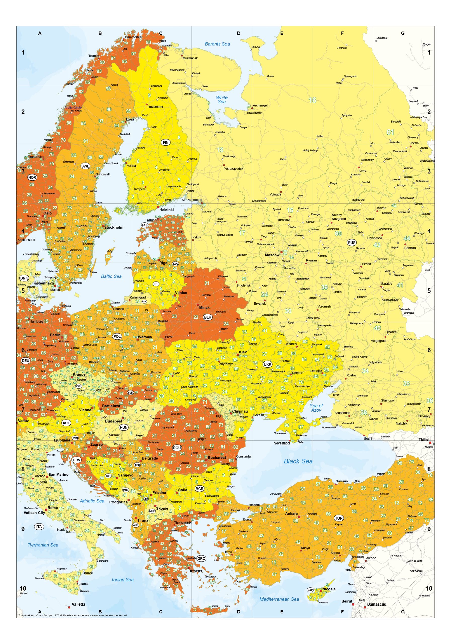
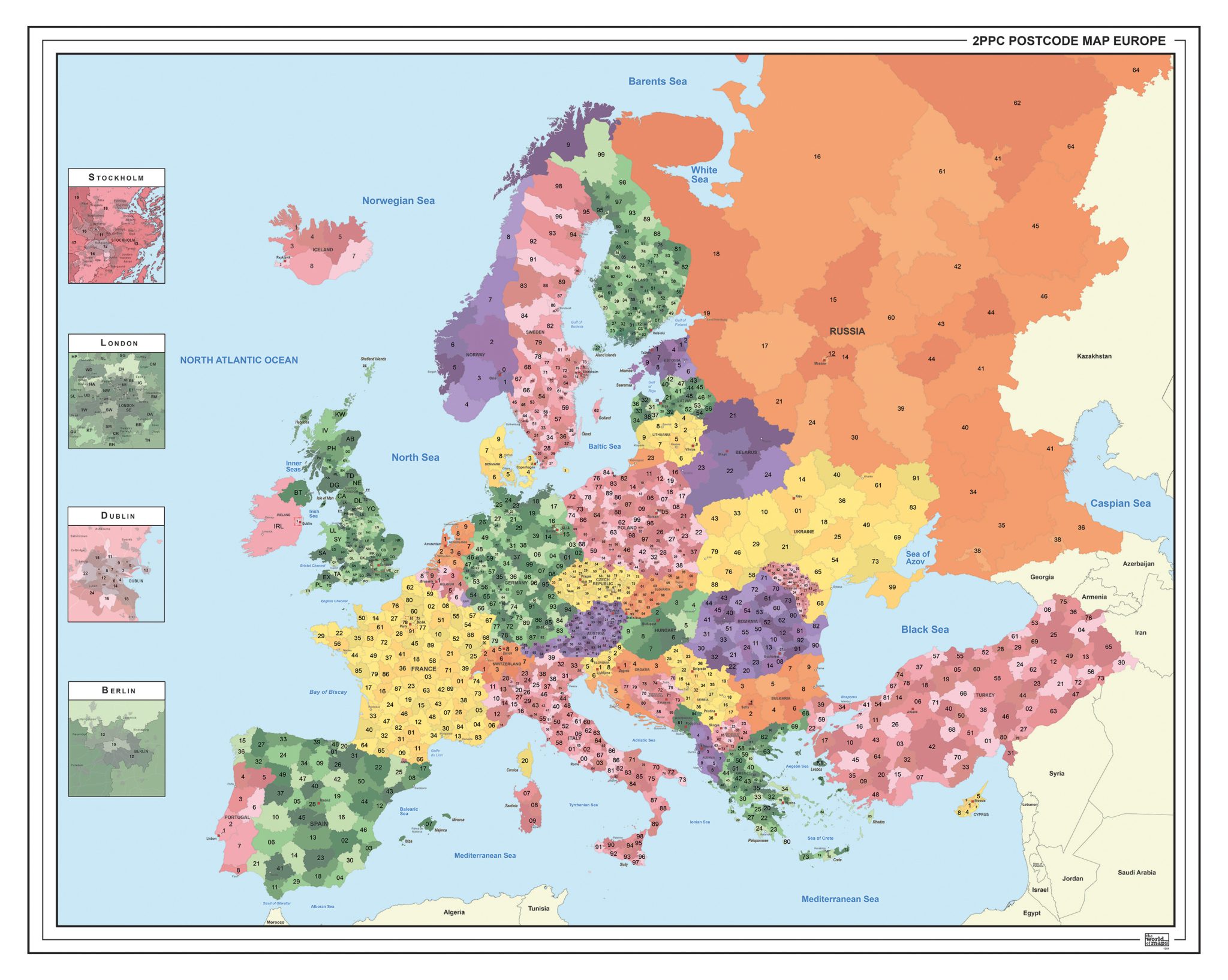
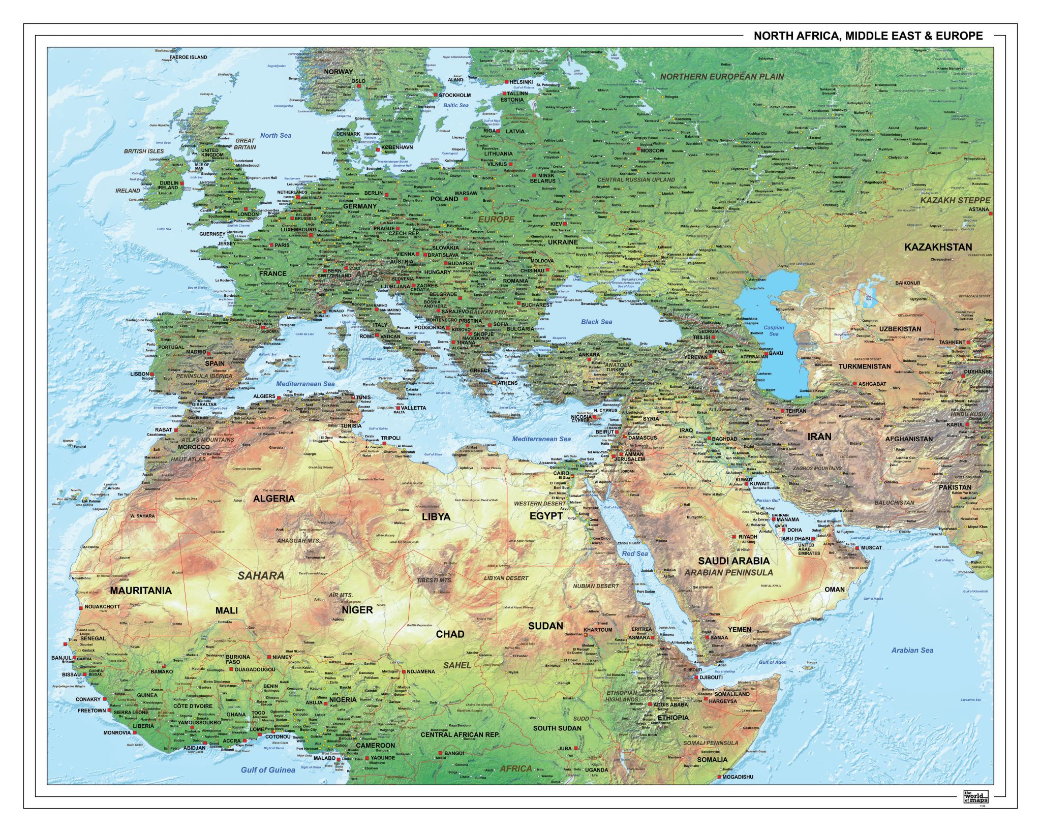
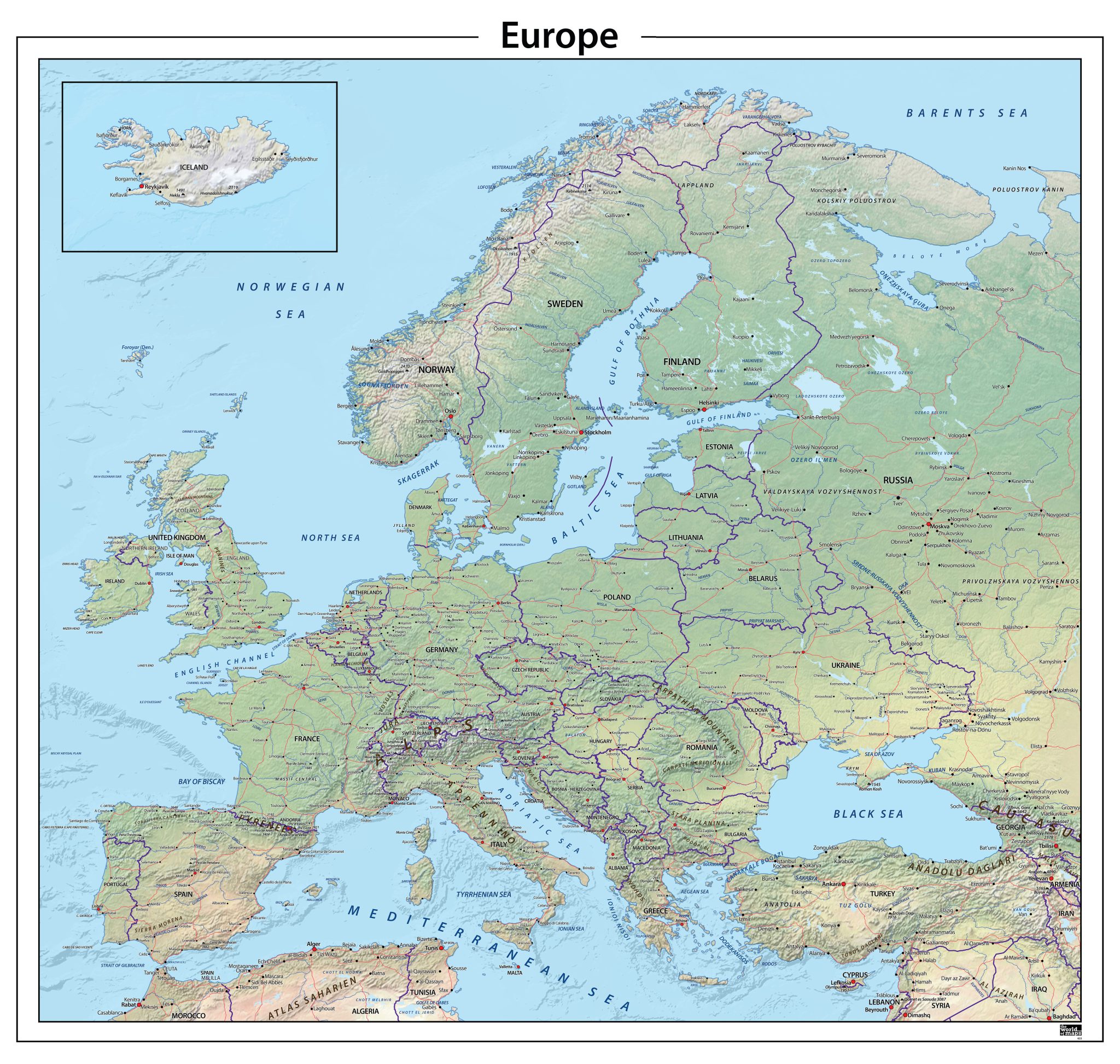
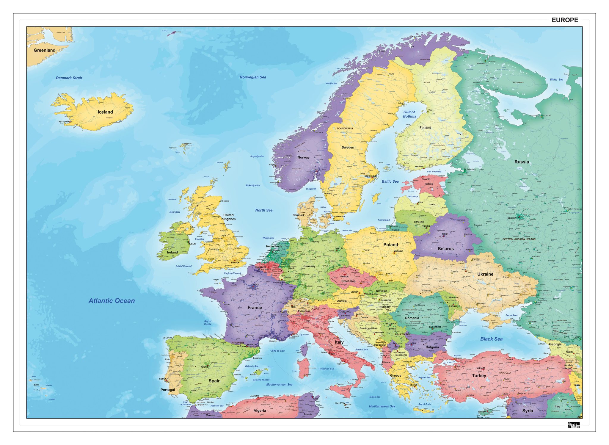
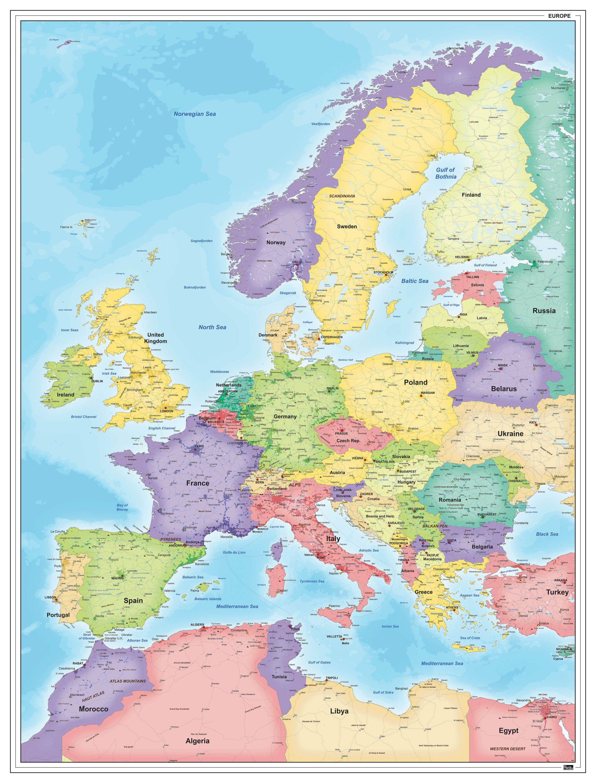
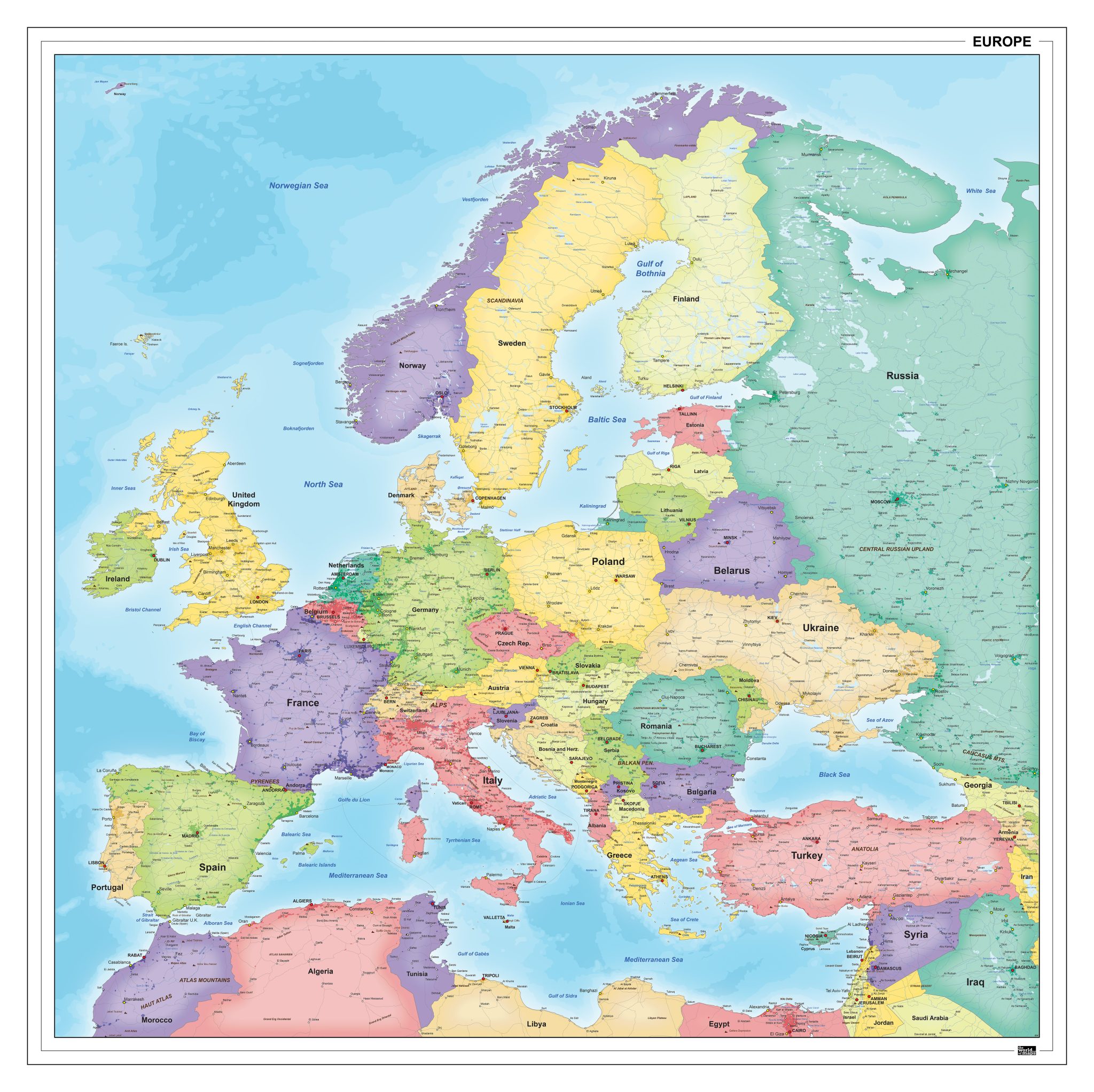
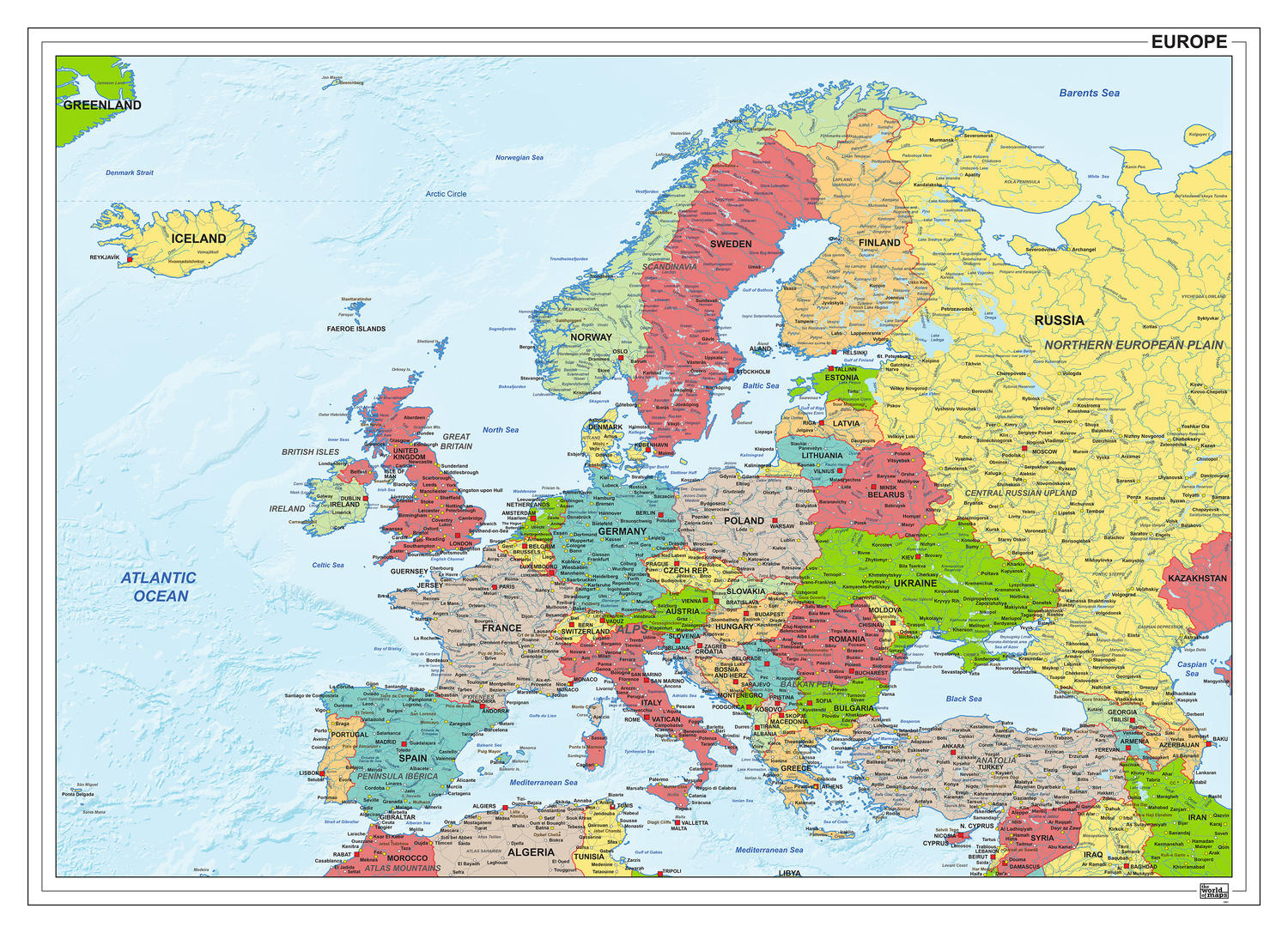
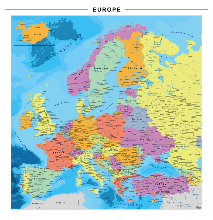
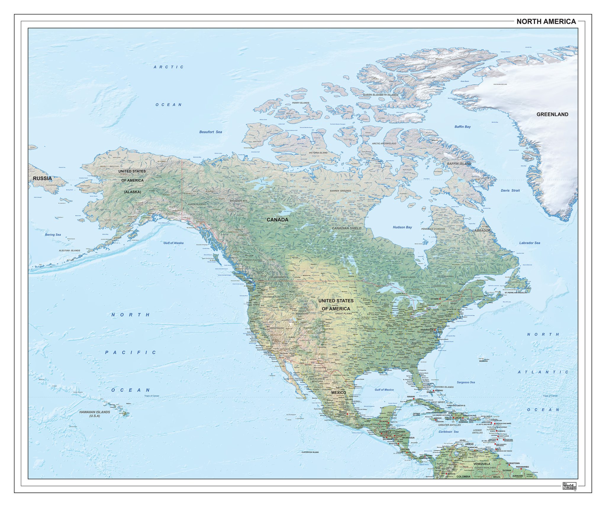
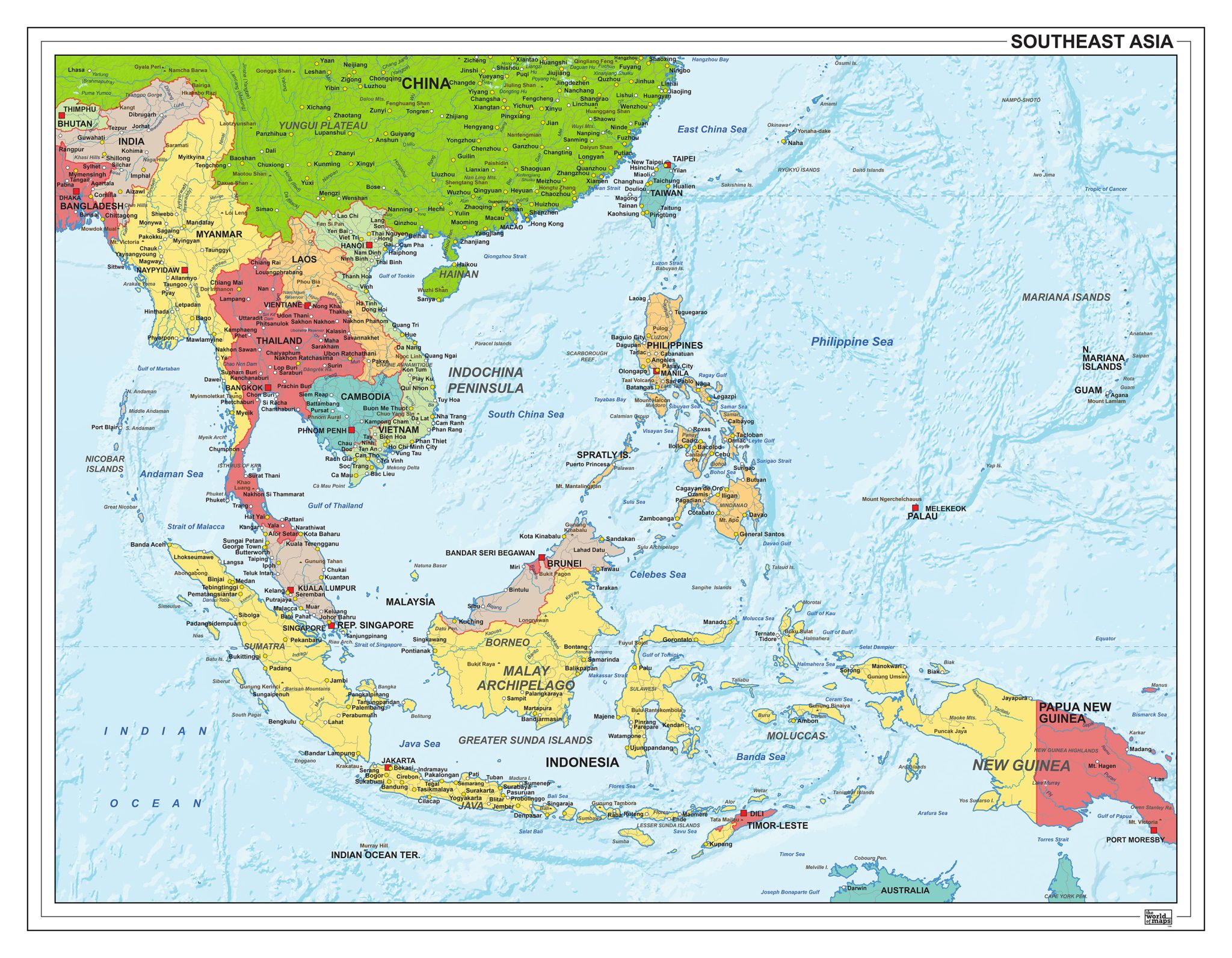
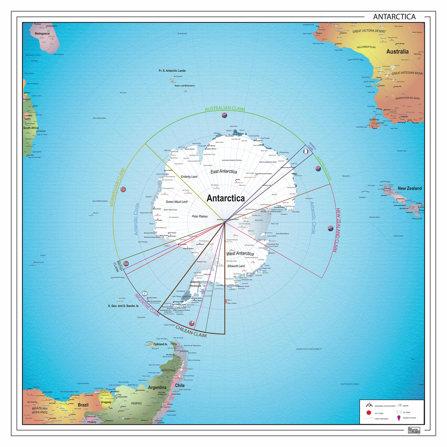
This category brings together a broad collection of digital maps covering all major continents, from Africa and Europe to North and South America. In addition to full continental overviews, the selection includes detailed maps of specific regions such as the Middle East, Southeast Asia, the Benelux and the Caribbean. Depending on the map, the focus may lie on political boundaries, natural features or a combination of both. Each map is designed for professional use and provides a clear, structured geographic overview suitable for print, design, education and digital applications.

Continent & Regional Maps – Political, Physical and Regional Focus

Our continent maps offer a flexible way to visualise large geographic areas as well as more focused regions within continents. Whether you are working with an entire continent or a clearly defined subregion, each map provides a balanced combination of detail, clarity and visual consistency. All maps are supplied as high-quality digital files, suitable for both large-scale overviews and more detailed regional analysis.

Available Map Types

Political Continent Maps
Clear representation of countries, borders and administrative divisions, ideal for reference, education and editorial use.

Physical / Natural Continent Maps
Maps that emphasise terrain, relief, rivers and landscape structure, offering insight into the natural geography of each continent.

Regional Maps
Focused maps of specific areas within continents, such as economic regions, cultural zones or geographically coherent areas.

Professional Digital Files

All continent maps are delivered as EPS & JPG downloads, offering maximum flexibility:

  • scalable without loss of quality

  • suitable for large-format printing

  • ideal for graphic design and publishing

  • compatible with professional design software

Designed for Accuracy and Clarity

Each map is created using reliable geographic data and recognised cartographic principles. Projections and visual styles are chosen to ensure a clear and readable representation of large geographic areas, while maintaining accuracy and spatial balance.

Why Choose Our Continent Maps

✔ High-quality EPS & JPG downloads
✔ Coverage of all continents and many world regions
✔ Suitable for print, design and educational use
✔ Clear visual structure with professional cartography
✔ Consistent style across continental and regional maps